
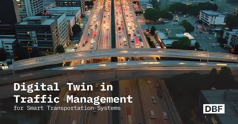
Exploring Digital Twin in Traffic Management for Smart Transportation Systems
Digital twin traffic management is revolutionizing how cities tackle congestion, emissions, and safety challenges. This blog explains how real-time modeling, predictive analytics, and scenario testing improve mobility and resilience. It highlights global case studies and shows how DB empowers planners for sustainable, future-ready transport systems. · September 9, 2025

From heavy rush-hour traffic to blocked ambulances and increased carbon emissions, traffic congestion isn’t just a daily annoyance but a growing urban crisis. According to the INRIX 2023 Global Traffic Report, urban city car owners spent over 100 hours per year sitting in traffic. Not only is it infuriating, it's also costing billions in lost economic activity.
Conventional traffic management systems are often inadequate, lacking real-time response, inter-system communication, and predictive modeling to simulate what's around the bend.
But times have changed. A groundbreaking technology is changing the way cities manage mobility: digital twin traffic management.
What is Digital Twin Traffic Management
A digital twin is a virtual copy of a city's entire transport networks, which includes roads, junctions, traffic signals, vehicles, and pedestrians, tied to real-time and historical data. With virtual copies of transport systems, you can simulate traffic flows and congestion in real-time, to test out different interventions, and to predict future patterns of mobility with unprecedented accuracy.
Digital twins leverage the power of intersection predictive modeling and provide data-driven city traffic planning. Cities can move from reactive to scenario planning for transport, congestion mitigation, route optimization, and public safety optimization, all without physical adjustment.
These systems are based on real-time data inputs and can learn to respond to real-world situations like weather, accidents, or infrastructure breakdown. More significantly, they are predictive systems that employ machine learning and simulation to suggest the best traffic management measures.
Why Cities Are Adopting Digital Twins for Traffic
Urban centers are under pressure to modernize their transportation systems. Here’s why digital twin traffic management is becoming a go-to solution:
- Congestion in cities is worsening: It will take the world $300 billion annually in urban congestion by 2030.
- Legacy systems are outdated: Older traffic planning plans use no real-time data whatsoever or dynamically adjust to evolving conditions.
- Smart cities need adaptive tools: Sensors, GPS, IoT, and monitoring infrastructure are already in place, but the potential exists for real-time modeling—a processing tool is missing.
- Environmental requirements: Transport is responsible for virtually 25% of all emissions. Cities require evidence-based solutions to provide climate objectives through enhancing mobility systems.
Some of the other drivers include the growth of shared mobility services, autonomous vehicle planning, and citizens' demand for improved commuting experience. Traffic twins help cities proactively address these shifts and craft long-term mobility visions.
How a Traffic Digital Twin Works
In the heart of a traffic digital twin platform is the simulation, capture, and optimization of traffic behavior. And here's how you achieve it:
1. Data Ingestion
- Collects real-time data from road sensors, GPS, traffic lights, cell phones, and CCTV cameras.
- It is linked with previous traffic volumes, population trends, and land-use policies.
2. Real-Time Modeling
- Constructs a live mobility simulation of the complete transport network.
- Duplicates intersections, signal timing, vehicle traffic, pedestrian crossings, and public transport routes.
- Dynamic adaptation to varying data inputs.
3. Predictive Analytics
- Applying AI in intersection predictive modeling, traffic congestion, and traffic bottlenecks.
- Tests measure such things as dynamic signal timing, new bus lanes, or emergency rerouting schemes.
- Forecasts short and long-term impacts of proposed policies.
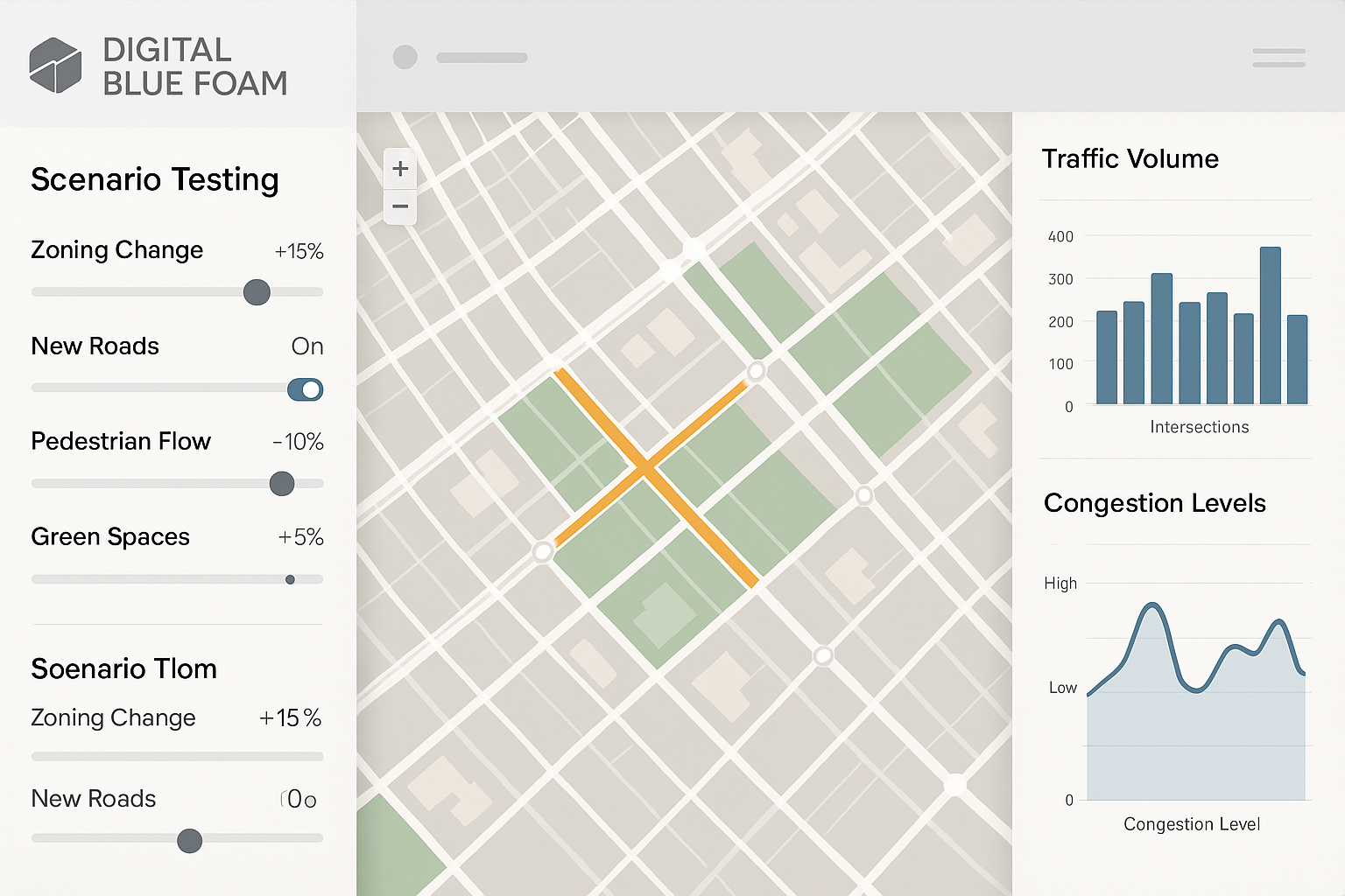
4. Scenario Testing
- Enables planners to try out different "what-if" situations: construction zones, mass gatherings, zoning regulations, or trends in EV adoption.
- Mimics real-time control, enabling data-driven management of city traffic.
- Supports the citywide contingency planning and resilience process.
Benefits of Digital Twin in Smart Transportation
Smart cities using digital twins are witnessing real-world benefits in mobility, security, and sustainability. The application of predictive traffic modeling by Singapore, for instance, decreased mean travel time by as much as 15% in test corridors. Similarly, the application of traffic digital twins with environmental sensors by Barcelona decreased localized emissions at traffic nuisance points by 21% in two years.
Here’s what the technology enables: across mobility, safety, and sustainability.
Here’s what the technology enables:
- Decreases congestion by predictive signal timing
- Assists in redirecting traffic during emergencies or rush hours
- Enhances public transport route
- Observes impact of changes in city shape (e.g., introducing a bus lane).
- Supports reduction of emissions
- Promotes multimodal integration—by combining cycling, walking, road, and transit infrastructure
- Promotes equity by establishing underserved mobility areas
These benefits extend beyond traffic. Emergency responders can be more easily deployed. School areas can be better protected. City air and noise can be better optimized.
Real-World Applications and Case Studies
Singapore’s Intelligent Transport System
Singapore Land Transport Authority created one of the world's most advanced digital twins using GPS, fare information, CCTV video feeds, and weather feeds. Its federated architecture platform has Esri ArcGIS for spatial analysis, machine learning-based traffic congestion forecasting, and VISSIM for microscopic traffic simulation. Its outputs are optimization of signal synchronization, congestion reduction, and multimodal planning. These advantages lowered average travel time by 8% and bus delay by 12% within the first year of operation.
Helsinki’s Multimodal Transport Simulation
The Helsinki city-scale digital twin replicates cycling paths, pedestrian structures, and autonomous vehicle behavior to facilitate planning for carbon-neutral multimodal transport. Backed by GPS data, public transport APIs, and an engine co-created with Forum Virium Helsinki, the model facilitates forward-looking planning and people-oriented development by replicating peak-hour traffic and weather phenomena like snow and fog.
New York City’s Midtown Traffic Pilot
NYC pilot-tested a digital twin of Midtown to monitor taxi, bus, and delivery traffic. It was used to test the effect of congestion pricing on traffic. Night-time delivery zones were also simulated, streamlining logistics without contributing to daytime traffic. The system was built on a hybrid stack of open-source software like MATSim and IBM proprietary data engines. During pilot testing, it proved to reduce congestion by over 18% owing to delivery.
Curitiba’s Bus Rapid Transit Modeling
Curitiba, Brazil, is using a digital twin to streamline its globally renowned BRT system. AVL data model, ticketing APIs, and GIS mapping simulate passenger density and predict future capacity needs. It has made the city able to map hotspots of congestion during peak service hours and redesign bus lane geometries to optimize flow. Singapore's Land Transport Authority built one of the most advanced digital twins using GPS, fare data, CCTV feeds, and weather models. Results have included improved synchronization of signals, reduced congestion, and multimodal planning with zero disruption.
How Digital Blue Foam Enhances Traffic Management Planning
Among the new technologies, Digital Blue Foam (DBF) is at the forefront of making smart traffic planning affordable and spatially informed. A recent example is a project in a mid-sized European city, where DBF modeled the impact of pedestrianizing a central shopping street. The model predicted a 28% drop in private car traffic, which was later supported after the intervention was implemented. As a senior transport planner on the project explained, "DBF allowed us to persuade stakeholders with evidence-based visualizations—something we had previously not been able to achieve.
Digital Blue Foam (DBF) is at the forefront of making smart traffic planning affordable and spatially informed. Here's how DBF helps planners:
Spatial Modeling & Scenario Testing
- Bicycle and pedestrian flow modeling, new roads, zoning
- Explain how design transformation impacts land use, congestion, and public space
- Envision multimodal transport spaces between urbanization scales
Integrated Environmental Intelligence
- Plot environmental conditions (emissions, noise, pollution) against traffic simulation
- Connect mobility with green infrastructure and air-quality targets
- Create high-impact interventions to help reduce urban heat and air pollution
Collaboration Between Urban Stakeholders
- Interactive dashboard enables the planners, engineers, architects, and civic leaders
- Evidence-based, graphic planning to aid informed decision-making
- Regulatory submission and public presentation of exportable results
Start adopting DBF to build smart traffic systems today. Design, simulate, and optimize your urban traffic system using DBF's digital twin technology.
Conclusion
With this pace of urbanization and climate emergency, traffic systems need to change. Digital twin traffic management is a shift from conventional static planning to dynamic data-driven mobility systems.
With tools like Digital Blue Foam, cities can test and try out changes in a virtual world, reduce risk, and create sustainable, responsive, and accessible transport networks. Smarter traffic starts with smarter design, collaboration, and simulation.
Try DBF's traffic simulation software today, before you construct tomorrow's roads.
Frequently Asked Questions
1. What is a digital twin in traffic management?
A digital twin refers to an online copy of the city traffic network based on real-time and historic traffic movement to simulate and regulate traffic. It enables cities to simulate and test scenarios of traffic movement and implement them first before implementing them in the real world, thereby making transport systems efficient, safe, and sustainable.
2. How do digital twins reduce congestion in cities?
Digital twins simulate traffic and congestion in real-time and apply AI to predict traffic congestion and offer predictive solutions in the form of signal timing and traffic diversion. This enables planners to make data-driven, informed decisions which reduce delays, optimize traffic flow, and avoid bottlenecks.
3. What are the benefits of smart traffic modeling?
Smart modeling helps in mitigating urban congestion, public transport optimization, multimodal transport planning, and supporting emergency response. It helps in supporting sustainability by minimizing emissions and scenario planning to predict the effect of urban design development before implementation.
4. How do digital twins address data privacy and system integration?
They have stringent data governance policies in place to offer anonymized data securely. They are interfaced with the current traffic networks and smart city infrastructure using APIs and open data standards to be interoperable and therefore can be implemented without the need to bring existing systems offline.
