
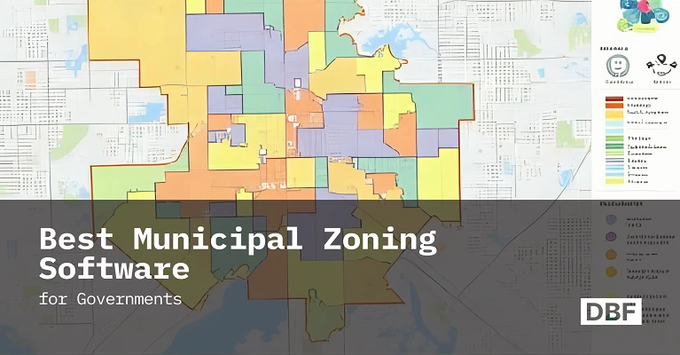
Best Municipal Zoning Software for Governments
Municipal zoning software helps governments replace outdated PDFs with interactive tools for real-time zoning, compliance, collaboration, and public transparency. This blog reviews leading platforms and highlights why Digital Blue Foam stands out with scenario modeling, climate metrics, and no-code simplicity, enabling faster, data-driven, and community-focused zoning decisions. · September 18, 2025

Zoning is a planning strategy that shapes cities and determines who benefits from growth, ranging from housing policies to green infrastructure. Zoning is where legislation meets public health.
Unfortunately, many municipal government tools are outdated, yet local government professionals continue to guide decisions about the present and future of our cities. Storing and maintaining bylaws, maps, and building regulations in PDF files or manual records is no longer practical.
Intuitive and data-driven platforms are the ultimate need of modern age planners and zoning departments that will allow decision makers to review the outcomes of their projected and existing policies while securely storing and managing data without the fear of loss.
In this blog, you will learn how leading zoning platforms are transforming local government, the role of emerging tools and why digital blue foam - DBF stands out in this list.
What is Municipal Zoning Software
The digital tools that help local government to manage, visualize and communicate zoning regulations are called municipal zoning software. At its core it replaces manual processes like interpreting PDFs or static land-use maps with interactive platforms that allow planners like you to:
- Visualize zoning bylaws in real time
- Manage and update local government land use data
- Testing of zoning changes before implementation
- Increase public transparency in zoning
- Departmental cooperation in a single digital setting
Whether it's drawing a new zoning district, reviewing development applications, or simulating future growth scenarios, zoning software allows local government planners to shift from reactive to proactive urban design for the city.
Why Zoning Software Matters for Local Governments
Municipal masterplanning departments have to do more with less and faster decisions, fairer plans and greener solutions but professionals in government bodies are still stuck using old tools and limited resources.
Here’s where zoning software makes a real impact:
Improved accuracy and compliance
Automated code-checking systems can instantly verify that proposed developments meet all zoning requirements, building codes, and regulatory standards, helping to prevent costly disputes and delays. These tools cross-reference project specifications against thousands of regulations in seconds, flagging potential violations before they become problems. This reduces the risk of legal challenges, minimizes revision cycles, and ensures that approved projects can move forward without regulatory roadblocks that could delay construction timelines and increase costs.
Increased transparency
Tools like public zoning portals allow residents to see what's happening in their neighborhood which builds trust in local government.
Faster internal workflows
Cloud-based features allow real-time collaboration between departments, enabling planners, engineers, and administrators to work on the same project simultaneously. This eliminates the traditional back-and-forth of email chains and version control issues, reducing project review times from weeks to days. Teams can instantly share updates, comments, and approvals, streamlining the entire planning process from initial proposal to final permit approval.
Scenario testing
Planners can experiment “what if” and “if then” scenario with density, height limits, or setbacks and immediately visualize outcomes.
Data-driven decisions
Provide features that enable users/planners to integrate diverse data sources quickly and easily often with just a few clicks.
Community engagement
Instead of showing static slides, planners can share live, interactive zoning models that make it easy for people to give feedback and understand what’s happening. For example, a recent initiative in Sharjah, UAE, where planners tested transit-oriented zoning overlays using 3D visualization tools. The outcome is Smarter land-use decisions aligned with the emirate’s mobility goals.
Meanwhile, in Singapore, the Urban Redevelopment Authority’s ePlanner tool supports data-rich 3D simulations to assess wind flow, sunlight exposure, and population density all before zoning decisions are finalized.
Key Features to Look for in Zoning Software
Not every tool is created equally. Whenever you are looking for the software or digital platform to help in zoning for your city remember one thing always go for the features which actually make your job easier.
One more thing to make sure software has an interactive map where you can layer different zoning types, infrastructure data, and land use overlays. And you are able to share updates publicly and collaborate with different internal and external departments in real time.
Cloud access matters too. Being able to continue work from the office, home, or field without worrying about lost files or outdated versions helps you stay productive.
You should also look for tools that let you test different scenarios. For example, changing height limits, setbacks, or density regulations. This helps you understand trade-offs and pick the best option before you commit.
Real-time collaboration makes a big difference. It helps your team work in one place, leave feedback, and keep track of versions without confusion. Look for tools with compliance checks, data integration, and the ability to export or share results quickly.
Comparison of Top Municipal Zoning Software Tools
Now let’s take a look at five leading zoning platforms widely used by municipalities and planning agencies around the world in Table 1 below. Each tool offers unique strengths depending on your city's size, needs, and technical capacity.
Table 1 Software Comparison
Choosing the right zoning platform depends on how your municipality approaches planning whether you need deep GIS functionality, streamlined compliance checks, or public-facing visualization. While some options are ideal for heavy data integration, others focus more on scenario evaluation or environmental metrics.
Additionally, ease of use and interdepartmental coordination can significantly affect how well these systems are adopted. Platforms that offer intuitive design, cloud accessibility, and multi-user access tend to fit better with modern planning workflows, especially where collaboration and speed are priorities.
Why Digital Blue Foam Stands Out
While all these tools offer value, DBF sets itself apart by delivering a real-time, visually immersive zoning experience that supports both technical analysis and stakeholder engagement.
Here’s what makes it special:
- Built for collaboration
Planners, engineers, and community members can work together in a shared 3D environment.
- Scenario modeling for density and land use
Adjust rules “what if “ and instantly see “if then” build-out potential.
- Climate and walkability metrics
Supports 15-minute city goals, energy modeling, and urban comfort analysis.
- No-code simplicity
Designed for planners not just GIS technicians so teams can focus on strategy, not software.
When zoning changes feel like guesswork, DBF adds clarity. When community trust is fragile, DBF offers transparency. And when time is short, DBF delivers fast, actionable insights.
Use Cases of DBF in Zoning Projects
Digital Blue Foam helps planners explore zoning changes in areas experiencing growth. It allows planners to adjust the "what if" scenarios and helps in measuring their impact and making better decisions.
It also brings different types of city data from mobility patterns to land use, socio-economic to public health into one place and this feature helps teams from different departments work together more effectively.
As each professional of a team uses the same platform, it's easier to align proposed zoning choices with broader goals like accessibility, sustainability, and long-term livability.
One practical use of DBF is in evaluating how projected density increases along transit corridors could affect overall livability rather than relying on flat maps or spreadsheets, planning teams can overlay zoning layers with road networks, building footprints, and service access points.
This approach enables planning and engineering teams to simulate the impact of densification while maintaining factors from sunlight access to walkability and by visualizing multiple outcomes side-by-side, teams can make more informed decisions rooted in real-world constraints.
Most importantly, DBF helps planners in developing strategies for climate-responsive zoning that can respond to climate risks. The reason is that the platform can work with city-wide data on heat levels and flood-prone areas, and this feature of combined analysis makes it easier to test how different zoning ideas might support actions like adding more green spaces to limiting building in flood zones which helps in decision making and eventually implementation of these strategies to reduce heat and manage flood risk over time. This tool is an asset for the government sector planner because it helps in better decision-making that takes care of both people and the environment.
Conclusion
Most city zoning tools weren’t built for the kind of work planners do today. Trying to manage big decisions through old PDFs or static maps just doesn’t hold up anymore. That’s where Digital Blue Foam really helps. It brings together the visual, the practical, and the collaborative without needing ten tools or a GIS expert.
You can test ideas, weigh the impact, and make zoning changes easier to explain not just to city staff, but to the public too. And if your team’s juggling density, walkability, and climate goals all at once, DBF keeps everyone working from the same page.
As cities continue to grow and face dramatic pressures from climate change to affordability, zoning tools must rise to meet the moment. With platforms like DBF, planners are no longer just drawing lines on maps; they’re shaping resilient, inclusive, and future-ready communities.
DBF might just make your next zoning update smoother, clearer, and a lot faster.
FAQs
What is municipal zoning software and why is it important?
Municipal zoning software helps local governments manage, visualize, and test zoning rules digitally. It replaces outdated tools like PDFs with interactive maps and real-time simulations.
How does Digital Blue Foam (DBF) support better zoning decisions?
DBF allows planners to model scenarios in 3D, test zoning impacts instantly, and collaborate across departments all without needing coding or GIS expertise.
What makes DBF different from other zoning tools like ArcGIS or Symbium?
Unlike others, DBF focuses on real-time 3D visualization, climate metrics, and ease of use, making it ideal for early-stage planning and community engagement.
Can DBF support climate-responsive planning?
Yes, DBF integrates data like heat levels and flood zones to help test zoning strategies that support sustainability and climate resilience.
Links
https://www.wam.ae/en/article/bjkkphy-sharjah-geographic-information-systems-forum
https://urbanfootprint.com/platform/climate-and-hazards
https://www.digitalbluefoam.com/feature/procedural-texturing
https://www.digitalbluefoam.com/feature/environmental-report
https://www.digitalbluefoam.com/feature/parametric-typology-editing
