
Best 3D Modeling Software for Sustainable City Design
Sustainable city design aims to reduce environmental impact while meeting economic and social needs. Advanced 3D modeling tools play a vital role by enabling planners to simulate energy use, climate effects, and urban layouts before construction. Tools like Digital Blue Foam (DBF), Revit + Insight, Rhino + Ladybug, ArcGIS Urban, and SketchUp + Sefaira support different planning stages and expertise levels. DBF stands out for early-stage climate analysis, while Revit excels at detailed building modeling. These tools foster data-driven decisions, reduce carbon footprints, and help design livable, eco-friendly cities. Choosing the right tool depends on project scope, team skill, and design phase. · June 16, 2025
Sustainable city design balances environmental, economic, and social needs. With cities consuming about 75% of global energy and producing approximately ~ 70% of emissions, planners must use smart tools to address climate change and livability.
Software plays a key role: advanced 3D tools for city planning let planners simulate scenarios, test green infrastructure, and make data-informed choices.
As the APA notes, “3D modeling and design evaluation software empower planners by simulating various configurations and gauging their outcomes before construction”, which encourages data-driven decisions for equitable, livable cities.
Why is 3D Modeling Important for Sustainable Design?
In sustainable city planning, 3D modeling is a valuable tool that helps to design according to environmental factors. 3D modeling allows architects and planners to create digital designs of cities and neighbourhoods, and simulate things like wind and sunlight patterns, even heat buildup.
By using 3d models, designers can test various ideas with real-time climate data, energy use, and pollution levels, turning guesses into data-informed decisions.
Most importantly, 3d modeling supports life-cycle thinking. This lets teams estimate total carbon emissions, material waste, and maintenance needs from the beginning and adjust designs to reduce them.
Top 3D Modeling Software for Sustainable City Design
Below, we review five leading tools. Each excels in different areas and suits various users:
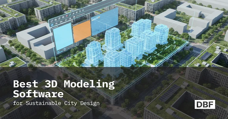
1. Digital Blue Foam (DBF)
DBF is a modern design tool that helps with sustainable planning in the early stages of a project. It integrates AI, spatial analytics, and real-world data into easy 3D massing tools. Planners and architects can quickly draw basic building layouts (“massing”) and immediately see environmental metrics. DBF was built for "sustainable building design" at the concept stage.
Built-in climate analysis
Instant daylight autonomy, solar radiation, wind scores, and annual shadow studies are computed in real-time as you edit the model. Designers can explore DBF’s urban climate modeling capabilities through sustainability analysis reports that show wind direction, average speed, and seasonal sunlight and shadow patterns.
Neighborhood scoring
Built in 15-minute city analysis looks at walkability and accessibility, nearby amenities, and CO2 emissions based on the area. This supports smart area decisions and helps create a more eco-friendly mix of land uses.
BIM integration
Although for early design, DBF exports to BIM/IFC and sync with multiple software. This means early-stage models carry environmental data forward into detailed design.
Best Use
DBF is best for early feasibility and master planning. It is great for generating quick scheme options and comparing sustainability metrics before detailed design begins. It’s tailored to planners looking for rapid eco-feedback on urban layouts. By seamlessly blending AI and data, DBF helps teams learn how DBF supports sustainable urban planning from day one of a project.
2. Autodesk Revit + Insight
.png)
Autodesk Revit is a leading software used for building design. It can allow users to evaluate how the building will perform by integrating Audesk insights. Revit creates detailed 3d models of the building, while insights adds tools to test sustainability.
Energy & Carbon Modeling
Revit works with insight to energy simulation planning of how a building uses energy and HVAC systems. Insights shows easy-to-read dashboards for energy use and carbon emissions, so designers can compare multiple ways to save energy.
Solar and shading analysis
Revit includes tools to study sunlight and supports extra solar analysis plugins. This helps architects to make sure buildings get enough natural light without any harsh heat effects.
Lifecycle focus
Insight tracks both the carbon produced during the construction and during building use ( operational carbon). This helps teams to make a selection between materials, like concrete or wood, to reduce total carbon impact.
Best Use
Revit and Insight are great for detailed building design. Especially useful for architects and engineers. These tools are best for improving single units or individual buildings rather than planning entire cities.
3. Rhino + Grasshopper + Ladybug Tools
.png)
Rhino is a flexible 3D NURBS modeling tool popular in architecture. Together, these tools create flexible sustainability workflows.
Climate-driven analysis
Ladybug and Honey both work inside Grasshopper to run detailed simulations for sunlight, shading, and energy use (HVAC).
Custom workflows
Because Grasshopper is code-free but versatile, advanced users can script complex scenarios (e.g., optimize facade panels or run Monte Carlo analyses) and automate sustainable design rules.
Free and Open-source
Ladybug tool is a free, open-source software. It connects Rhino and Grasshopper to trusted simulation tools like EnergyPlus.
Best Use
It is best for advanced users and researchers. It’s especially useful in architecture films or universities working on custom simulations or research. If the project involves complex building designs or detailed climate analysis, Ladybug Tool is a strong choice.
4. ArcGIS Urban
.png)
ArcGIS Urban (by Esri) is a 3D city planning platform built on GIS. It excels at scenario planning and policy analysis at the city or district scale. Urban lets planners place zoning, land use, and design proposals within a detailed 3D model of the real city.
3D Scenario Modeling
Users can create realistic digital models of cities by placing buildings, streets, and parks in their surroundings. This helps show how changes might affect views, shade, and green areas.
Policy Simulation
ArcGIS Urban lets planners test different zoning rules and development plans. They can see how new buildings fit local rules or how adding more buildings could affect growth. It also helps measure things like extra housing, floor space, or energy use for each option.
Data-Driven Analytics
The platform includes useful city data like population density, land use, and access to public transport. Planners can also add maps showing climate risks, such as flood zones or heat areas, to ensure environmentally responsible plans.
Best Use
ArcGIS Urban is best for long-term city planning. It’s widely used by governments and large cities to review and share big development plans, like new neighborhoods or zoning updates. Its main strength is analyzing city-wide data and helping communicate ideas clearly with 3D visuals, not detailed building energy analysis.
5. SketchUp + Sefaira
.png)
SketchUp is a beginner-friendly 3D modeling tool known for its easy interface and large library of ready-made components. Sefaira is a plugin for SketchUp that adds features to check a building’s energy use, daylight, and ventilation. Together, they make sustainable design quick and accessible.
Energy Simulation
Sefaira uses trusted tools (EnergyPlus and Radiance) to quickly run energy and daylight simulations. Designers can test different building shapes, directions, and window sizes to see how they affect energy use, heating and cooling needs, and indoor comfort.
Daylighting and Comfort
Sefaira gives feedback on how much natural light enters a space and how comfortable the indoor temperature will be.
Easy to Use
No coding or advanced training is needed. You just draw the building in SketchUp, choose basic settings like building type, and run the analysis. The results are simple to read, with color visuals and easy tables showing things like sunlight and estimated energy bills.
Best use
Great for early design stages, especially for small architecture firms, students, or solo designers. SketchUp + Sefaira is perfect when you need fast, reliable feedback without complex software. It’s a great tool for exploring energy performance during the planning phase.
Comparison Table
Here’s a brief overview of leading tools in sustainable design, outlining their main focus areas and key strengths.
How to Choose the Right Tool
Expertise Level
Beginners may find SketchUp or DBF easier to use, while experienced users might prefer Rhino with Grasshopper for custom analysis or Revit for detailed BIM workflows.
Project Type
ArcGIS Urban is best for large-scale city or zoning plans. For designing single buildings, tools like Revit, SketchUp, or Rhino work best. DBF is useful for both building and neighborhood projects, so it’s great for master planning.
Design Stage
At the early design stage, DBF, SketchUp with Sefaira, or Rhino with Ladybug give quick and helpful feedback. For later stages, like detailed design or construction, Revit is better because it offers more accuracy and detail.
Data and Analysis
If you need solar, wind, and eco-metric dashboards right away, tools with built-in simulation (DBF, Ladybug, Sefaira) are best. If GIS and demographic data are central, consider ArcGIS Urban or DBF’s spatial analytics.
By matching your team’s skills, scale of work, and analysis requirements, you can pick the best 3D modeling solution for a given sustainable design challenge.
How DBF Simplifies Sustainable Design
.png)
Digital Blue Foam is built specifically for sustainability from the ground up. Its online platform streamlines early-stage planning: as soon as a form is drawn, DBF automatically computes relevant sustainability metrics.
You can explore DBF’s climate modeling capabilities through its interactive dashboards and instantly see outcomes like solar shading, daylight factors, and CO₂ scores. This “instant feedback loop” means designers don’t have to switch between multiple complicated tools because DBF combines data collection, 3D modeling, and environmental analysis all in one platform.
Its guided workflows make it easy for both planners and architects to use, allowing teams to quickly see how building shapes and climate factors interact without needing extensive training.
For example, a city planning team can use DBF to design a neighborhood and quickly see how easy it is to walk around, how much shade there is, and how much carbon the area produces. They can then send the design to BIM software to continue working on it.
This all-in-one process helps teams make faster decisions while focusing on sustainability, showing how DBF works as a smart city planning software and makes early city planning greener and easier.
Conclusion
Modern cities need better tools to help them become more sustainable. The software we talked about, like DBF’s AI planning and Revit’s detailed energy checks, each offers something useful. Together, they show that eco-friendly design software is now stronger and easier to use than before.
By using 3D models to simulate sunlight, wind, energy, and more, planners can create greener and stronger cities. We encourage you to try these tools, whether it’s SketchUp with Sefaira for a quick look or DBF’s platform for deeper sustainability work. These tools help make city planning that is both comfortable to live in and better for the environment.
Sustainable design isn’t just a good idea; it’s necessary, and the right software helps turn smart urban plans into real life.
FAQs
What is sustainable city design?
It is the practice of planning and building urban areas in ways that minimize environmental impact while meeting social and economic needs.
Why is 3D modeling important for eco-friendly planning?
3D modeling lets planners visualize ideas and run analyses before anything is built. It also helps communicate plans to the public. In short, modeling tools enable “data-informed decision-making” that saves costs and improves sustainability outcomes.
Which 3D modeling tools support energy simulation?
Many popular tools include energy analysis features. For example, Autodesk Revit (with Insight or Green Building Studio) can simulate hourly energy use for buildings. Even specialized urban tools like DBF offer carbon and energy scoring for master plans. These tools use simulation engines to predict performance early in design.
How does DBF compare with other tools?
DBF is distinct in focusing on early-stage, high-level planning with sustainability built in. Unlike Revit (which models detailed building components) or ArcGIS Urban (which focuses on zoning scenarios), DBF operates at the city/neighborhood scale. It is more accessible than coding and provides immediate climate analysis without plugins.
External Links
https://www.autodesk.com/products/insight/overview#:~:text=sustainability%20tools
https://www.esri.com/en-us/arcgis/products/arcgis-urban/overview#:~:text=3D%20scenario%20modeling
