
Steps to Develop a Water Supply Master Plan in an Urban Area
A Water Supply Master Plan guides cities in securing reliable, climate-resilient water systems through demand forecasting, infrastructure assessment, and community input. Digital tools like Digital Blue Foam integrate GIS, modeling, and collaboration to optimize design, cut costs, and ensure sustainable, regulation-compliant water networks ready for future growth and challenges. · August 14, 2025

Strategic planning is the first step toward urban water security. A city's water plan is a guide that helps provide clean and reliable water to the citizens for a long time. Urban planners must think about future needs and create reliable systems as populations increase and infrastructure ages.
According to one city, its master plan “assesses the future water requirements and identifies the necessary projects to fulfill that demand.” By doing proactive modeling of demand, climate impacts, and infrastructure gaps, planners ensure reliable service and promote climate-resilient growth.
It's critical to acknowledge the urgency. UNESCO has warned that by 2050, almost 6 billion people may face water scarcity due to the growing demand for water worldwide. Proactive planning is crucial in urban areas to avoid crises like extreme drought or overuse of limited resources.
Master plans help cities deal with changes like growing water demand, rising costs, and less water coming from outside sources. These plans help to decide where to build pipelines, storage options, treatment plants, and conservation initiatives. This also helps save water, and this strategy helps climate resilience and supports sustainability goals as well, making it a key part of getting ready for future needs.
What is a Water Supply Master Plan?
A Water Supply Master Plan (WSMP) helps a community take care of its water for many years. It is a plan that shows how to make sure there is enough clean water for everyone. The Water Supply Master Plan (WSMP) gives advice on what to build, like water pipes and tanks, and where to get water from.
This plan also assesses how much water people will need in the future and helps the city spend resources in the right way to keep the water system working well.
The Water Supply Master Plan (WSMP) changes every 5 to 10 years. This is because things change, like rules or how much water people use. Changing the plan helps the city make better choices and keep the water system working.
It describes methods for meeting future water needs while guaranteeing resource conservation. It supports environmental and urban planning goals, such as balancing development with public health, climate resilience, and conservation.
For example, the Santa Clara Valley plan explicitly aims to meet 100% of the yearly water demand in years when there isn't a drought and at least 80% in years when there is.
To make this work, a detailed supply-demand analysis and a clearly defined project pipeline are required. A Water Supply Master Plan (WSMP) helps keep a city’s water system safe, strong, and flexible. It is a guide that helps the city decide how to spend money and make good choices about water.
Key Components of a Water Supply Master Plan
A detailed water master plan covers key topics to ensure it is complete and based on data.
First, the plan reviews how much water people will need in the future. To do this, planners study things like population growth, land use patterns, and economic growth. They also use models to guess future water use. These models include things like census data, changes in rain, and how fast underground water refills.
Next, the plan takes a close look at all the existing water systems. This includes pipes, treatment plants, pumps, water tanks, and water connections to homes and buildings(offices/hospitals,/warehouses). Using maps made with GIS (Geographic Information Systems), planners/engineers can see where every pipe, valve, and hydrant is.
These maps help find areas that might have problems, like not enough water or possible leaks. Planners/Engineers use hydraulic models to study the current water system. These models look at water use and pipe data to find problems like low pressure, weak fire-flow, or old pipes that may fail.
The models also help plan the right size for new pipes or pump upgrades and find spots where the system is too tight or slow. The master plan ensures compliance with relevant laws, rules, and sustainability goals. The report assesses relevant standards, including drinking water quality regulations and seismic & climate adaptation requirements.
The plan might follow state regulations or include an emergency response policy. A master plan must follow all relevant laws and health standards. This includes rules about water quality, safety, and emergency planning.
A Water Supply Master Plan (WSMP) helps a water system stay strong and manage risks well. It prepares for unexpected events like pipe breaks, droughts, and earthquakes. Modern plans also get ready for climate change by including backup systems like extra treatment capacity, recycled water, and desalination.
These backups help make sure there is enough water during long droughts or if the system has problems. All these parts come together to give a clear picture of how the water system works over time. They help keep the plan current, prepared for future growth, and strong enough to handle unexpected events.
Steps to Develop a Water Supply Master Plan
A Water Supply Master Plan (WSMP) is made by following simple steps. Planners/Engineers usually move through each step one by one. If they learn something new, they may go back and make changes to earlier steps.
Step 1:
The first step is to decide which area the plan will cover. This includes the region that gets water service and how far into the future the plan will look—often many years ahead. To understand the current situation, planners collect data. They study how land is used, how fast the population is growing, what the current water system looks like, and how clean the water is.
Step 2:
Next, planners use this information to build a model of the current water system. This helps them guess how much water people will need in the future and find any problems or gaps in the system. Engineers then come up with solutions. These might include building new wells, fixing or replacing old pipes, or updating water treatment plants.
These projects are then put into a list called the Capital Improvement Program (CIP). The most important projects are placed at the top of the list.
Step 3:
The CIP checks how well these projects would work in different situations, like during a drought or a time of fast growth. Planners use tools and models to see if the plan can handle these future challenges.
Step 4:
During the planning process, the community is also involved. Planners ask for feedback from the local communities to business owners. They hold a public gathering to listen to everyone’s ideas and opinions about the plan. This feedback is then used to improve the plan.
In the end, this strategy helps in creating a plan that fits the community’s needs and earns their support. It also makes sure the water system will work well both now and in the future.
Benefits of Using Digital Tools in Water Master Planning
Modern digital tools make it easier and more effective to create a Water Supply Master Plan (WSMP). Tools like data platforms, hydraulic modeling software, Geographic Information Systems (GIS), and Digital Blue Foam (DBF) help planners do their work faster and understand water systems better.
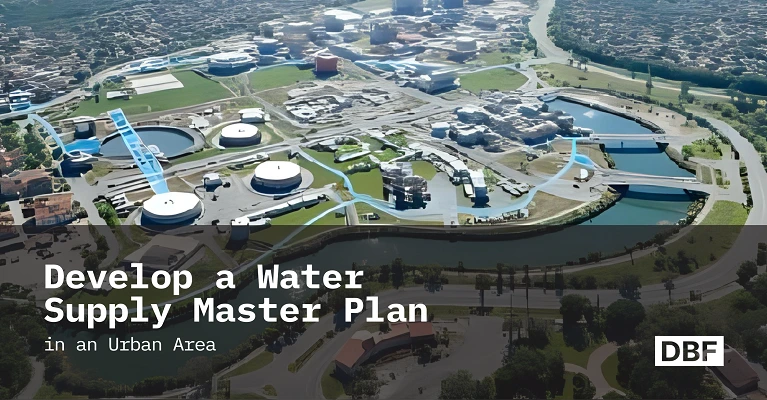
One major benefit is better mapping and visuals. Digital maps let planners see important things like pipelines, water sources, and meters all together. GIS software makes clear and detailed maps that show where changes are needed. These maps can be linked to the DBF platform using shapefiles, which helps make designing easier.
Another benefit is quicker water demand forecasting. Smart software can use data like water usage, population growth, and weather to predict how much water will be needed in the future.
Planners can also test different situations using digital tools. For example, they can use digital models to practice how the system would respond to emergencies or to see how upgrades like adding a new treatment plant or pipeline would work. This helps them prepare better and make sure the changes will really work.
This makes planning and execution more effective by allowing planners to verify that proposed improvements address identified problems. Digital tools like Digital Blue Foam (DBF) also help different departments, such as planning, engineering, operations, and finance work better together.
Shared dashboards and data platforms make sure everyone uses the same up-to-date information, which improves teamwork and helps make better decisions. Also, improve the Capital Improvement Plan (CIP). They help planners avoid building too much and focus on the most important projects.
By using smart maps and risk tools, cities can cut down on repair and upgrade costs. This helps them find cheaper and smarter solutions before any construction begins.
In short, digital tools turn raw data into useful information for planning and designing. They make the planning process faster, more precise, and more engaging. With these modern technologies, cities can quickly adjust to new information and ensure their water systems are ready for future needs.
How DBF Supports Water Supply Planning
Digital Blue Foam (DBF) is a powerful digital tool that helps planners and engineers create better water supply systems. It brings together important information such as zoning, population numbers, land use plans, and sustainability goals.
All this data is combined in one place, so planners & engineers can clearly understand what is needed to provide. This includes assessment of residential patterns, growth trends in different areas, and how many resources are available.
DBF also makes it easier to understand complex information and turns data into simple visuals like maps and charts, so everyone involved in the planning process can easily see and understand what is being proposed.
The platform also makes it easy to check that all plans follow safety rules and climate guidelines. This helps ensure that the ideas being developed are both smart and safe. When the planning is finished, DBF allows users to quickly share maps and designs with engineers, builders, and on-site professionals.
This helps professionals do the work quickly and reduces delays and confusion, and it also helps in saving time and lowering costs. Because Digital Blue Foam DBF supports teamwork and clear communication, different groups, such as the government, private companies, can work together easily.
Everyone can review different ideas, compare options, and make better decisions. By using Digital Blue foam (DBF), cities can build strong and reliable water systems that are ready for the future and meet the needs of the people who live there.
Conclusion
A strong water supply plan is important for cities to manage the impacts of climate change. By forecasting future water needs, assessing available resources, and planning system upgrades, cities can avoid shortages and service disruptions. This kind of strategic planning is especially critical today, as population growth and climate change continue to accelerate.
Platforms like DBF show how modern planners can successfully integrate networks, zoning, and demographics to create reliable and sustainable water systems. With DBF, every decision about a new pump, pipe, or policy can be made with data-driven confidence.
Use DBF to build smarter infrastructure models today. It is possible to simulate demand, optimize distribution, and design robust solutions in a matter of minutes rather than months by using sophisticated GIS mapping or a complete digital twin.
An efficient water supply strategy, enabled by the right digital platform, ensures the long-term safety and prosperity of urban areas. Plan your next water infrastructure project with DBF.
FAQ’s
1. What is a water supply master plan?
A long-term, integrated strategy that ensures an urban area's future water demand is met through reliable infrastructure and sustainable resource management.
2. Why is water planning critical in urban areas?
Because cities face growing demand and climate risks, systematic planning prevents shortages, promotes efficiency, and protects public health as populations and weather patterns change.
3. What tools are used in urban water supply planning?
Planners use GIS and hydraulic models to map and analyze networks, along with digital twins and data analytics for scenario simulation. These tools let cities visualize systems and test solutions for challenges like drought or system failures.
4. How does DBF support sustainable water infrastructure planning?
DBF is a spatial planning platform that integrates population, land use, and environmental data to model urban water systems. It enables quick scenario testing and visualization, helping planners optimize water distribution and resilience in line with sustainability goals.
Links
https://frontlineadvisorygroup.com/the-ultimate-guide-to-the-capital-improvement-program-process/
