
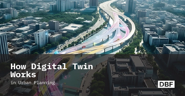
How Digital Twin Works in Urban Planning
Digital twins are real-time, data-driven virtual models of cities that integrate GIS, sensors, and AI to simulate scenarios for better urban planning. Unlike static tools, they enable faster decisions, stakeholder collaboration, and sustainability optimization. Platforms like Digital Blue Foam make creating and testing these dynamic city models easier and more effective. · August 11, 2025

Urban planning is evolving rapidly. Digital Twin for Urban Planning represents an innovative approach where a city’s physical assets and systems are mirrored as a virtual replica of urban systems. In this living model, planners can run city simulations for decision-making and generate data-driven urban scenarios to evaluate the impacts of changes.
Conversely, traditional planning tools depend on isolated spreadsheets and static CAD or GIS snapshots. These approaches don't have real-time context; thus, it's challenging to guess what will happen when new policies or changes happen.
Urban planners typically struggled to obtain all the necessary information and could not easily evaluate "what if" scenarios, but digital twins address these issues by linking the real world with the virtual world.
What Is a Digital Twin in Urban Planning?
A digital twin in urban planning is not just a 3D map; it is a representation of a whole city that is constantly changing and based on data. Experts in the field say that it is "a true, dynamic digital representation of a municipality and its infrastructure" made from sensors, GIS, geographical data, and other sources.
In real life, its existence implies that every street, building, and utility line in the twin is the same as the one in the actual world. The twin can even have information on zoning rules, energy use, or population. A digital twin is different from standard CAD or GIS models since it gets updates immediately from real-time feeds.
A city's digital twin, for instance, may get live traffic data, meteorological data, and electricity grid loads all at the same time. Planners may then view these layers in 3D, such as when witnessing traffic jams in the afternoon (shown in orange on the streets in software) or figuring out which neighborhoods' solar panels provide the most electricity.
In short, a digital twin is a full, real-time model of a city. It combines 3D representations of buildings and landscapes with dynamic information, which is far more than what static GIS layers can do on their own. Digital twins are strong because they can link to real-time data and transform it into a 3D visualization. They learn from the city itself all the time, so the model keeps up to date when conditions or development change.
How Do Digital Twins Work in Urban Planning?
Digital twins use many different technologies and data sources to run simulations on a city-wide scale. Some of the most important parts and steps are
Data Integration
Twins integrate geospatial, zoning, mobility, climate, and real-time operational data such as GIS layers, satellite imagery, traffic feeds, and sensor-based environmental inputs.
3D & 4D Visualization
A digital twin uses 3D and 4D modeling technologies to create a virtual replica of the city, where 4D includes changes over time, such as seasonal traffic, construction phases, or weather patterns, allowing planners to visualize streets, buildings, parks, and energy use.
Stakeholder Collaboration
Interactive tools (like browser-based or AR/VR platforms) enable planners, engineers, and policymakers to explore urban scenarios together and test changes in real time.
Real-Time Updates & Simulation
A digital twin updates live from sensor feeds, offering a real-time view of infrastructure. It can detect traffic disruptions or simulate transit changes. New York’s subway twin, for example, helps staff monitor and manage tunnel operations.
Predictive Modeling
Digital twins use data-driven algorithms to predict future events, using AI and statistical models to predict traffic patterns, parking needs, and climate simulations. This allows planners to test "data-driven urban scenarios," like adding lanes or changing zoning, examining impacts on traffic, pollution, energy consumption, and emergency response times.
Even the DUET project in Belgium uses a twin to analyze traffic variations and air quality changes.
Key Benefits of Using Digital Twins in City Planning
Digital twins offer numerous advantages that compensate for the limitations of older instruments. The best things about it are
Making Decisions Faster
Digital twins enable planners to quickly assess the current state of municipal systems, reducing the time spent on data collection and assessments. These "strategy accelerators" help expedite approvals and reduce delays in real-life applications.
Effective Scenario Testing
Digital twins enable city planners to test out various scenarios in 3D before making decisions, ensuring fact-based decisions. For example, Singapore's Virtual Singapore twin helped assess the traffic and environmental impact of new buildings. Scenario testing also aids in long-term city planning by assessing emissions, energy consumption, and population expansion over time.
Better Communication with Stakeholders
Digital twins simplify complex planning data for non-specialists by providing 3D models for straightforward understanding. They enable sharing simulations with community members, municipal governments, and private developers, fostering trust and reducing confusion among different agencies. This improves coordination, saving time and money.
Digital twins have the potential to increase public involvement. Residents are often asked to use the twins' interface to see ideas in context for numerous projects. They could look into how a new park would change their community or vote on their favorite ideas. This participative method makes planning more open to everyone and helps planners get useful feedback from the community early on.
Sustainability Optimization
Digital twins can assess the environmental effects of planning choices, such as carbon emissions, green space allocation, and energy consumption. This helps cities align development with climate goals.
All of these features together make digital twins a very useful planning tool. They turn static, manual tasks into a flexible, multi-faceted workflow. Digital twins will soon be "a must-have for any planning commission or agency," according to one industry analysis. Their popularity is because they give planners and agencies an essential insight into how the city works.
Example Use Cases
People are already using digital twins to tackle real problems in cities. Here are some intriguing examples:
City planners are using digital twins to prepare for climate hazards by simulating stormwater floods and landslides using computerized elevation models and meteorological data. This helps identify at-risk roads and structures and allows for the development of climate-resilient infrastructure, reducing risk and ensuring longer-lasting infrastructure by evaluating strategies for climate adaptation in a virtual environment.
Digital twins are being used by transit organizations to improve service and maintenance, such as New York's Metropolitan Transportation Authority's 3D subway map and Belgium's DUET project. These twins enable field staff to assess infrastructure using X-ray vision, enabling real-time decision-making and rerouting of traffic, thereby ensuring reliable and efficient transportation systems.
Even EV charging infrastructure in many cities is now being planned using digital twins, incorporating factors like current EV adoption, traffic patterns, grid capacity, land use, and zoning. The algorithm predicts future growth and optimizes charging locations in days, acting as a network to ensure infrastructure is installed where it is most needed, thereby speeding up the rollout of EV networks.
Digital twins are also helping cities plan affordable housing. By layering data on income, zoning, land availability, transit access, and service proximity, planners can simulate where affordable housing will have the greatest impact and ensure equitable urban development.
Digital Twin vs Traditional Urban Planning Tools
When you compare digital twins to older planning tools, you can see how beneficial they are:
- Traditional CAD or GIS maps are static, providing a snapshot of a period. Digital twins, on the other hand, constantly update with new data, ensuring planners use the most current information.
- Digital twins, based on simulations and algorithms, replace manual calculations and expert judgment in planning. They allow for accurate simulations and predictions, transforming the process from guessing to making decisions based on facts, as described by Dexory (DexoryView, a company name).
- Digital twins combine various fields like transportation, energy, floods, and housing, allowing stakeholders to view the same model. This all-encompassing method allows for quick assessment of impacts on various sectors, unlike traditional tools that focus on one part of the problem.
How DBF Helps Build Digital Twins for Urban Planning
The Digital Blue Foam platform is an AI-powered tool for urban planning that enables rapid creation of 3D models of cities with minimal data. It offers built-in layers for regulatory and environmental data, allowing planners to add zoning maps, height limitations, land-use rules, sun radiation, and meteorological data to the model.
DBF also provides real-time site feasibility analysis, allowing planners to recalculate effects in seconds when experimenting with new scenarios. Its unique capabilities include the ability to create professional reports and scenario simulations with just one click, allowing users to export charts, maps, and descriptions of each scenario they tried.
The software makes city planning a collaborative, data-rich process, enabling planners to acquire predictive analytics, stakeholder interaction, and smart simulations without extensive learning. DBF's digital twin technology revolutionizes the field of urban planning.
Conclusion
Digital twins are changing the way we plan cities—from a static art to a dynamic science. Planners can make quicker, better choices by creating interactive, data-driven models of cities. These virtual city models let teams test zoning changes, improve infrastructure, and design more sustainable environments long before they start building.
Digital twins are no longer just a concept for the future; they are a planning tool that offers real advantages today. Cities that want to be innovative must use digital twin technologies. It is easier and more effective to develop a city's digital twin using platforms like Digital Blue Foam.
DBF gives planners the power of a digital twin with capabilities like AI-assisted modeling and real-time scenario simulation. Use virtual simulation to help build smarter, safer, and more sustainable cities using DBF.
Use DBF to build your city’s digital twin today and shape smarter, safer, more sustainable urban futures.
Digital twins are here to stay, and they’re transforming how we plan and care for cities.
Frequently Asked Questions
1. What does "digital twin" mean in urban planning?
A digital twin is a virtual representation of a city, displaying real-time data like traffic and weather. It's constantly changing based on sensor data and user interaction, allowing urban planners to analyze scenarios and make smarter planning decisions, unlike traditional static maps and GIS models.
2. How does a digital twin help cities grow?
A digital twin supports city growth by enabling data-driven decisions. It helps planners simulate impacts, streamline permits, coordinate agencies, and involve the public, reducing risks before construction begins.
3. What technologies do you need to make digital twins of cities?
City digital twins use GIS, 3D modeling, IoT sensors, cloud platforms, and AI. Tools like BIM, CAD, and photogrammetry turn real-world data into virtual models, often combining open data with aerial images.
4. How does DBF stack up against other planning models?
Digital Blue Foam (DBF) offers a dynamic, all-in-one platform that updates 3D models in real time. It lets planners test zoning, design, and infrastructure scenarios while integrating regulations and environmental data.
5. What cities in the real world employ digital twins?
Cities like Singapore, Boston, Toronto, Vancouver, Montreal, and Bologna use digital twins to enhance infrastructure, transport, and sustainability, proving their real-world value.
Link
https://gis4schools.readthedocs.io/en/latest/part1/1_3.html
https://sigmaearth.com/sustainable-development-practices-in-urban-planning/
https://www.adaptation-undp.org/climate-resilient-infrastructure
https://www.digitalbluefoam.com/capabilities/spatial-analytics
https://living-in.eu/sites/default/files/files/digital-twins-wg-foresight-report.pdf
