
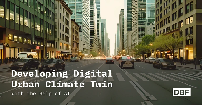
Developing Digital Urban Climate Twin with the Help of AI
Digital urban climate twins are transforming how cities prepare for climate risks like heat waves and floods. This blog explains their core technologies, applications, and benefits, showing how AI enhances forecasting, simulation, and resilience scoring. It highlights how DBF empowers planners with data-driven tools for climate-sensitive, proactive urban planning. · September 2, 2025

Urban areas in all parts of the world are facing ever more climate-driven dangers, like worsening heat waves, floods, and air pollution. More than half a billion individuals live in urban areas globally, and they face threats that most directly jeopardize billions of individuals (United Nations).
The infrastructure in place today is not strong enough because it was predominantly constructed decades ago and did not prepare for the extremes of the modern climate (ASCE). Traditional planning approaches fail to address the urgency of such issues, as they are usually reactionary and disjointed (ITDP).
This gives them essential data for adaptation to climate change and building resilience. This escalating emergency indicates how vital it is to possess developed, consolidated planning tools.
Digital urban climate twins are one such technology. Planners can see climate scenarios in real time with the help of these virtual replicas of cities (BCP). Cities can focus on infrastructure investment, risk planning, and anticipatory adjustment by capitalizing on real-time data, predictive analytics, and scenario simulation with climate twins.
New technologies, including artificial intelligence (AI), are required in a bid to utilize these tools to the fullest. Digital Blue Foam uses AI‑driven spatial and environmental analytics to surface patterns and support data‑informed planning decisions.
What is a Digital Urban Climate Twin?
A digital urban climate twin is a highly detailed virtual model of a city that was made to look like how climate conditions affect cities.
Unlike traditional digital twins, which usually focus on general infrastructure and operational scenarios, urban climate twins use real-time environmental data, predictive analytics, and complex simulations to predict climate-related problems (WBA , ITDP).
Planners and policymakers are able to comprehend and react to urban climates in real time due to the fact that they incorporate satellite imagery, sensor information, climate history, and live monitoring. Regular planning tools won't allow you to completely view and forecast climate situations on the ground.
Urban climate twins, however, allow individuals to make decisions in advance rather than in reaction by integrating data from multiple sources into interactive scenario-based models. Planners can visualize how effectively things such as planting more, putting pavement in a more porous state, or modifying zoning regulations perform by, for instance, instantly demonstrating how heat islands influence dense city centers or visualizing what would occur if there were a high amount of rain and flooding.
Digital Blue Foam exemplifies this approach as a browser‑based AI platform for generative design and spatial/environmental analytics. Digital urban climate twins can help cities manage climate uncertainties by enabling faster, data‑driven planning and scenario comparison.
Urban climate twins use a host of emerging technologies to successfully model, predict, and counteract the effects of climate change. AI is just one such vital component, namely, machine learning algorithms with pattern identification and prediction capacities for climate hazards.
The algorithms work on enormous volumes of data, such as temperature fluctuations, rain patterns, wind speed, and pollutant levels, in an attempt to do it right when it comes to future occurrences. This is the predictive capability that allows planners to visualize possible dangers like heat waves or floods months before they occur and therefore act very quickly.
Core Technologies Behind Urban Climate Twins
Climate modelling and spatial analysis digital twin platforms, such as Digital Blue Foam, must also be created. They integrate real-time data from the environment with data from a vast number of diverse sources, including vegetation cover, land use, building types, and infrastructure networks. Planners can immediately derive actionable insights with interactive visualization systems. Users can explore and test proposed changes dynamically and assess how to reduce their impact.
Urban planners can improve their urban plans over time with the assistance of a virtual world that replicates the real world and updates itself as the climate alters. These are satellite-based images and urban sensor networks, which give real-time high-resolution environmental data that is crucial for accuracy. Satellites monitor conditions like weather patterns, urbanization, vegetation health, and surface temperature.
Ground sensors, on the contrary, remain static in position to perceive the likes of humidity, air quality, and water levels. Sensor networks in smart cities like Singapore, for example, provide real-time streams of accurate, location-based climatic data, improving predictive modelling and city resilience (Omnisight).
Finally, advanced simulation engines are able to simulate detailed city processes like thermal heat islands, stormwater runoff, flood dynamics, and air pollution dispersion. These engines assist planners in determining how infrastructure functions, under varying weather conditions.
This helps them choose materials, identify where to place green infrastructure, and efficiently alter zoning that will allow cities to grow in a way that is beneficial to the environment as a whole and disaster-resistant. AI-powered tools give you real-time, graphical projections of climate impacts by analyzing continuously updated information like weather reports, city growth, and infrastructure updates.
Planners can also instantly envision how a heat wave is set to strike particular neighbourhoods and use this vision to make quick strategic decisions like planting trees, building green roofs, or launching focused cooling shelters. These AI features have far-reaching practical applications.
For example, when the planners make new infrastructure proposals or zoning plans, AI-based climate twins are able to expose what would happen right away. This makes it easy to envision how current decisions will have an effect on long-term urban sustainability and resilience. City planners are thereby in a position to make better investment and policy priority decisions that will help communities adapt to and withstand climate change effects better.
Rotterdam and Singapore have, for instance, used such foresight data to upgrade drainage systems, build retention basins, and employ permeable surfaces in order to protect critical infrastructure and residential neighbourhoods.
This integration guarantees that city growth not only provides space for expansion but also increases the resilience and sustainability thereof in a positive direction, preferably with the aim of larger climate adaptation goals.
How AI Powers the Climate Twin
Digital urban climate twins are driven by artificial intelligence and enable cities to better observe, plan for, and respond to climate issues. Real-time forecasting and scenario visualization are two of the most significant capabilities of AI in this context. For instance, DBF enables planners to assess solar exposure, shadows/daylight, and wind‑flow tendencies (via Ingrid Cloud) to inform climate‑sensitive siting and design (DBF).
Some of the most important ways AI strengthens digital climate twins include:
- AI-driven adaptive models adjust settings and forecasts as cities expand, policies evolve, and new developments arise.
- DBF allows planners to compare alternative layouts and growth scenarios using KPIs such as access, carbon, and density.
- Detailed policy-impact modelling is supported through integration with specialist tools.
- AI enhances urban climate twins with resilience scoring and comparative analysis to measure how scenarios respond to climate stresses.
- Resilience scores allow planners to equitably compare zoning regulations, building materials, and design options.
- These insights guide decision-making on the placement of green infrastructure to mitigate urban heat, improve energy efficiency, and strengthen resilience.
AI equips planners with powerful tools to evaluate climate-sensitive design decisions in an equitable, data-driven manner. By applying forecasting, adaptive modelling, and resilience scoring, Digital Blue Foam helps ensure that climate twins remain responsive to evolving city dynamics while supporting strategies for long-term urban resilience.
Key Use Cases and Benefits
One of the key applications of digital urban climate twins is to locate urban heat islands, which are very hot areas compared to the surrounding environments, and to experiment with solutions to reduce their temperature. Urban heat islands have been located by cities such as Melbourne and Barcelona using climate twin technology in neighbourhoods that are extremely hot (iRAP).
Planners have employed digital twins to visualize how the introduction of green roofs, urban forest, and shaded walkways reduces temperature in particular locations and, in turn, makes the city more habitable as a whole. Such simulations provide tangible evidence for focused interventions, hence making stakeholders more likely to invest in green infrastructure projects.
Another significant application is determining where floods will occur in cities. Urban areas are being flooded increasingly, and the stormwater infrastructure that used to function is not always adequate. Urban climate twins employ sophisticated flood prediction models that consider the topography, the volume of rain, and the ability of the existing infrastructure.
This allows them to precisely forecast where they will probably flood. Cities like Rotterdam and Singapore have applied such predictive information to upgrade drainage systems, build retention basins, and establish permeable surfaces to protect key infrastructure and housing communities (Business Insider).
Climate twin simulations also make it far simpler to understand how materials used in building influence micro-climates. Planners utilize these computer programs to observe how materials impact the heat and air quality of cities.
For instance, builders and architects can utilize simulations to assist them in selecting materials for rooftops, sidewalks, and facades that pass through heat, allow water, and reduce the temperature in buildings. Such materials can assist in making neighbourhoods cooler and more relaxing.
Ultimately, digital urban climate twins assist planners in ensuring that climate adaptation and urban growth policy integrate with each other. Digital Blue Foam’s spatial analytics support infrastructure and growth discussions; comprehensive zoning code checks are geography‑specific, such as the Hikari module for Japan.
Such integration makes sure that urban development not only provides room for growth but also helps improve the resilience and sustainability thereof to an ideal degree, as it relates to the larger climate adaptation needs.
How Digital Blue Foam Enables Digital Urban Climate Twins
Digital Blue Foam enhances urban planning with its sophisticated, AI-driven features that are specifically designed for creating and managing digital urban climate twins. The platform integrates multiple spatial and environmental datasets, including solar exposure, shadow/daylight analysis, and wind scoring; in some contexts (e.g., Japan via Hikari), it also supports zoning rules. It then provides instant feedback and scenario modelling that are critical in climate-informed planning.
- Integrates environmental datasets such as solar exposure, shadow/daylight analysis, and wind scoring (via Ingrid Cloud).
- Provides instant scenario modelling that shows the impact of design choices on urban climate, energy consumption, and resident comfort.
- Supports zoning compliance in specific regions, such as Japan through Hikari integration.
- Enables assessment of climate-sensitive factors like daylight, shading, and wind-flow tendencies to inform design and siting.
- Helps determine optimal positioning of green infrastructure to promote heat mitigation, energy efficiency, and resilience.
- Can be paired with hydrology or heat-island models to test flood management or urban-heat strategies.
These ground-level examples show the ways DBF can shift traditional planning into proactive, climate-resilient development. DBF equips planners and decision-makers with the capacity to apply sustainable, forward-looking city solutions confidently by making complex climate futures easier to conceive through simple-to-grasp, clear, data-driven imagery.
Conclusion: Building Resilient Cities with Digital Twins
Digital urban climate twins are a major step up for cities that need to be prepared for worsening climate dangers. Digital twins inform urban planners and city authorities about complex urban climates and anticipate issues before they escalate into crises through real-time data, predictive scenario simulation, and sophisticated visualization.
Digital Blue Foam is an excellent demonstration of the ways in which these powerful tools can be utilized to benefit and educate sustainable urban planning. City leaders, urban planners, and sustainability professionals now have the opportunity- and obligation- to utilize DBF's platform to make intelligent decisions that will enable cities to respond to climate change and become more resilient. Tools now exist that can assist cities in planning more effectively and becoming more resilient. It's time for cities all over the world to use them.
