
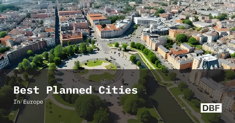
Best Planned Cities in Europe
Europe’s best-planned cities like Copenhagen, Amsterdam, Vienna, Stockholm, Barcelona, Freiburg, and Malmö showcase sustainable transport, mixed-use zoning, and climate resilience. This blog highlights their shared strategies and explains how Digital Blue Foam helps planners replicate these models through scenario testing, livability metrics, resilience simulations, and collaborative community-focused urban design. · September 25, 2025

Europe has long been a leader in urban planning innovation. As we approach 2026, certain cities stand out as models of smart urban planning, merging sustainability with AI, mobility, equity, and data-informed design. These exemplars set the benchmark for urban climate adaptation strategies, community-centric design, and integrated infrastructure.
This article highlights what defines a well-planned European city, presents top cities by case, and explains how tools like Digital Blue Foam (DBF) can help replicate these design standards in other contexts.
What Defines a Well‑Planned City?
A well-planned city in Europe today typically exhibits:
- Compact, walkable neighborhoods with mixed‑uses and pedestrian-first zoning.
- Resilient infrastructure for climate change adaptation, including mobility and green space.
- High-quality public transit access and extensive cycling networks.
- Public spaces and greenery integrated into dense urban fabric.
- Climate-conscious development and regulation through strong land‑use zoning.
- Community-driven planning, with participatory design processes.
- Integration of nature and infrastructure, balancing built form with ecological corridors.
These characteristics create a model for livable, compact cities that work for people, planet, and prosperity.
Best Planned Cities in Europe (2026 Edition)
1. Copenhagen, Denmark
Copenhagen aims to be carbon neutral by 2026–2028, having reduced CO₂ emissions by about 75% since 2005 through green energy, waste‑to‑energy infrastructure, and sustainable transport policy(Le Monde.fr). Its 350 km of segregated cycle tracks and ambitious cycling modal-share targets (50% of commuter trips) showcase smart urban planning and urban mobility excellence. The planned super bikeways network extends cycling infrastructure into metropolitan zones, promoting equity and connectivity.
2. Amsterdam, Netherlands
With over 320 miles of premium bike lanes, Amsterdam's cycling-first ethos, mixed-use zoning, and walkability standards make it one of Europe’s most livable, compact cities for active mobility and low-carbon urban life.
3. Vienna, Austria
Vienna combines affordable housing, transit-oriented development, and inclusive planning. Though specific sources weren’t covered here, its social housing model and strong tram and metro systems serve as benchmarks in European planning circles.
4. Stockholm, Sweden
Stockholm’s Hammarby Sjöstad eco-district has a full-cycle sustainability model integrating energy, water, and waste systems, promoting urban climate adaptation via district-level design and resource loops. Meanwhile, the upcoming Stockholm Wood City—Europe’s largest timber-built neighborhood—promises lower carbon construction and biophilic urbanism.
5. Barcelona, Spain
Barcelona’s Superblocks project limits through-traffic within 400m × 400m grids, reclaiming public space, reducing pollution, and boosting green area per capita by approximately 1 m². The urban mobility plan supports reduced vehicle use, expanded cycle lanes, and participatory design for car-free zones.
6. Freiburg, Germany
The Vauban district is a masterclass in community-centric, car-free neighborhood planning. With Passivhaus buildings, solar-plus energy-positive housing, and solar district heating, Vauban embodies sustainable city layout and energy autonomy.
7. Malmö, Sweden (Bo01)
Bo01, also known as the “City of Tomorrow”, was conceived as a 100% renewable energy neighborhood, combining aesthetic, ecological, and social goals. Its irregular street layout, waterfront integration, and citizen-centred design exemplify community-centric sustainable urban planning.
Planning Strategies These Cities Have in Common
Across these cities, shared planning strategies emerge:
- High‑quality public transport and cycling infrastructure.
- Mixed‑use and density management supporting local services and walkability.
- Environmental zoning and open data policies for transparency and climate adaptation.
- Participatory public space design, including tactical urbanism and community-directed interventions.
- Use of digital tools and real-time data in planning (e.g. Copenhagen’s RL-enhanced flood modeling.
How DBF Helps Cities Learn and Apply These Lessons
Scenario-Based Simulations
DBF enables planners to simulate density, mobility access, shading, and energy use scenarios. Planners can compare proposed designs against proven benchmarks like Copenhagen’s cycle modal-share curves or Barcelona’s superblock footprint.
Visual Livability Indicators
Walkability indices, solar exposure, shading studies, and green space overlays can all be generated in DBF, helping teams visualize public space design, integration of nature and infrastructure, and urban climate adaptation strategies.
Resilience Before Construction
DBF’s climate overlays support planners in modeling heat island mitigation, stormwater retention, and shade strategies prior to building—mirroring eco-district approaches used in Stockholm or Freiburg.
Benchmark Comparisons
Cities can compare their design outputs to metrics from best‑planned cities (e.g. cycling lane density, block scale, renewable energy share), then design plans to emulate those performance indicators.
Collaborative, Community-Centric Design
Cloud-based DBF simulations support stakeholder workshops where scenarios are adjusted in real time, aligning with community-centric planning models seen in Barcelona and Freiburg.
Conclusion
These European cities tell a consistent story: sustainability, connectivity, public space, and climate resilience are not luxury, they’re core to livable urbanism. Through data-informed urban planning, they represent aspirational models that cities worldwide can adapt.
To emulate their success, planners need tools that support scenario testing, stakeholder engagement, and performance benchmarking. Digital Blue Foam offers these capabilities, making it possible to visualize, simulate, and iterate design decisions in alignment with European planning excellence.
Unlock your city’s potential as the next great urban success story and start exploring DBF today.
FAQs
1. What makes a city well-planned?
A well-planned city has walkable, mixed-use neighborhoods, robust public transit and cycling networks, integrated green public spaces, climate-resilient infrastructure, and inclusive planning processes shaped by local communities.
2. Which European cities are models of urban planning?
Copenhagen, Amsterdam, Vienna, Stockholm (Hammarby Sjöstad), Barcelona (Superblocks), Freiburg (Vauban), and Malmö (Bo01) are widely recognized as planning benchmarks.
3. How can other cities learn from these examples?
Planners can adapt strategies such as tactical urbanism (superblocks), district eco-models (Hammarby Sjöstad), renewable energy districts, cycling infrastructure networks, and community-led design planning.
4. How does DBF help apply these planning best practices?
DBF enables zoning and mobility scenarios, livability overlays (walkability, shading, solar), climate adaptation modeling, and participatory simulation—helping cities replicate high-performance planning practices.
