
AI Technologies Behind Smart Urban Mobility Solutions
AI is transforming urban mobility by making transportation systems smarter, faster, and more sustainable. This blog explores technologies such as machine learning, computer vision, reinforcement learning, NLP, and digital twins, their real-world applications, and how Digital Blue Foam helps planners integrate data for predictive, citizen-focused, and climate-aligned mobility solutions. · August 25, 2025

Cities around the world are struggling with traffic jams, unstable transportation systems, surging pollution, and growing pressure on outdated infrastructure. These issues lead to congestion of commuters in the gridlocks, buses operating late, and emergency vehicles delayed by poorly synchronized signals.
Planners are often left navigating fragmented data and siloed tools, unable to test scenarios, predict outcomes, or make informed, citizen-centered decisions.
While AI is often promoted as a fix-all, many teams are struggling to manage the buzzword swamp and disconnected technology stacks. They lack a realistic knowledge of how particular AI technologies can address practical issues in urban mobility and how they can be directly incorporated into planning workflows.
This blog explores the specific AI mobility systems powering smart urban mobility, the practical problems they solve, how they integrate with urban AI transportation tools, and how platforms like Digital Blue Foam (DBF) are enabling these transformations through intelligent systems.
Understanding AI in Urban Mobility
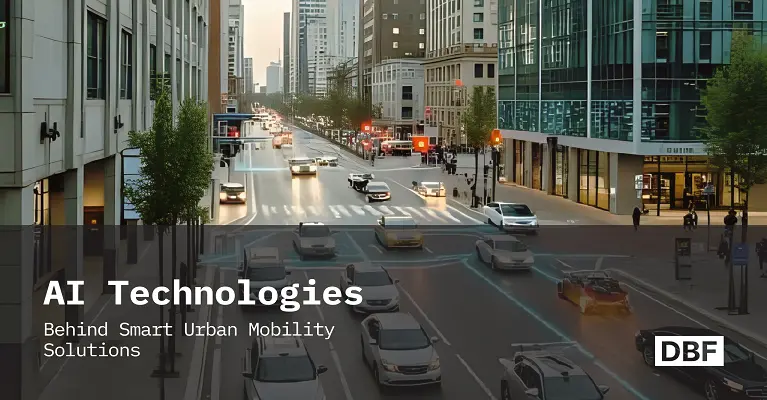
AI in urban mobility means using advanced algorithms and machine learning to make transport systems more efficient, flexible, and responsive to real-world conditions. This includes autonomous traffic control, route optimization, congestion forecasting, and simulation of movement across the city. Unlike old transportation systems, AI adapts in real-time based on continuous feedback through sensors, GPS navigation, traffic cameras, and user behaviour. AI can help urban designers and transportation experts decode the city dynamics and support data-based decisions at scale.
Challenges in Urban Transport AI is Solving
The population growth, changing land use, climate-related targets, and user expectations are putting an increased burden on urban mobility systems. The existing traditional tools are not agile and don’t have enough ability to process complex and real-time data. AI supports scalable and analytical ability, helping planners to work on multiple problems at once.
1. Traffic Congestion Prediction and Avoidance
Congestion is costing cities billions of dollars a year in lost productivity, fuel, and emissions. The INRIX Global Traffic Scorecard indicates that urban commuters are wasting more than 100 hours annually stuck in jams. AI models mitigate this by merging historical patterns with the real-time traffic information of GPS, IoT sensors, and mobile networks. These insights feed into AI-powered traffic management systems that reroute vehicles or adjust signal phases before delays occur.
2. Public Transit Scheduling
Static timetables often fail to reflect real-world demand variability. AI in transportation enables dynamic scheduling by analyzing the fare card data, occupancy sensors, and location data to understand which specific periods are especially busy and which routes might be underutilized.
3. Emergency Vehicle Routing
With the help of AI, especially reinforcement learning, routing systems can prioritize the route used by emergency vehicles according to current live conditions. These systems take into consideration traffic signal timing, construction zones, and congestion to reduce response times. In Fremont, California, the fire department reported a 62% reduction in emergency vehicle response times after implementing LYT’s AI‑driven routing and signal‑preemption system.
4. First/Last-Mile Optimization
AI can optimize the first/ last-mile connection by assessing demand density, terrain, weather, and availability of multimodal connections. This allows planning both shared mobility solutions (such as e-scooters or shuttles) and infrastructure (such as bike lanes or pedestrian corridors) in accordance with real commuter behavior.
5. Ride-Sharing Balance and Flow
AI supports the dynamic repositioning of shared mobility fleets. The predictive models estimate demand spikes in zones, helping operators to move idle vehicles in advance. Uber and Lyft are some of the firms that use real-time demand forecasting to allocate vehicles, decrease wait time, and maximize asset utilization.
6. Predictive Maintenance of Transportation Assets
AI is assisting cities to track the status of their public infrastructures, buses, rail systems, traffic signals, and road surfaces. By analyzing sensor data and usage patterns, AI can flag early signs of wear or failure. This enables the maintenance crews to take action prior to breakdowns, ensuring safety and less downtime. As an example, predictive maintenance of rail systems has the potential to cut unscheduled maintenance by up to 30 percent.
Key AI Technologies Behind Smart Mobility
AI in urban mobility depends on certain technologies. All these play a special role in transforming transport systems into smarter and more practical ones.
1. Machine Learning for Traffic Forecasting
The large datasets are analyzed through supervised and unsupervised machine learning models, like traffic sensors, GPS traces, mobile apps, and CCTV feeds. These models forecast the traffic levels, travel time, and bottlenecks. More advanced techniques like neural networks and ensemble models improve accuracy by identifying hidden correlations and non-linear trends.
Use case: Cities like Singapore and Los Angeles utilize machine learning to dynamically model congestion and change lane usage
2. Computer Vision for Pedestrian and Vehicle Recognition
With deep learning, computer vision analyzes pictures and video feeds of traffic cameras to detect road users, such as cars, bikes, buses, and pedestrians. Such systems can detect violations, jaywalking, and pedestrian traffic in designated areas.
Use case: Barcelona is applying computer vision with AI to study pedestrian traffic in busy areas. This will be used to redesign intersections for safety.
3. Reinforcement Learning for Adaptive Traffic Signal Control
The AI model experiments with timing strategies of the signals and receives a response (reward or penalty) according to the outcome. Eventually, it learns the right time to keep the traffic flow effective at different real-time situations, such as traffic jams, pedestrian crossings, or weather conditions.
Use case: Pittsburgh has been using reinforcement learning systems to apply adaptive traffic signals, which have led to over 25% reduction in travel time and over 40% reduction in idling period.
4. Natural Language Processing (NLP) for Citizen Mobility Feedback
Unstructured data, such as complaints by citizens, posts on social media, or reviews on a public transit app, can be analyzed with NLP and identify trends towards mobility. This gives the planners a human perspective of how the systems are problematic.
Use case: City transit agencies in New York and London analyze rider feedback using NLP to improve bus stop locations and subway service timing.
5. Digital Twins for Real-Time Simulations
A digital twin is a dynamic virtual model of a real city or transport system. AI improves these twins by supplying real-time data and simulating scenarios. Planners can visualize what happens when a lane is eliminated, a BRT line is installed, or parking is decreased.
Use case: Helsinki’s mobility digital twin simulates multimodal trips, helping planners test the impact of zoning decisions and infrastructure upgrades.
How AI Integrates with Urban Planning Tools
AI delivers the most value when it's not used in isolation. In urban mobility planning, it is the ability to integrate AI models with larger-scale planning tools: land use, zoning, environmental data, and infrastructure. The integrated platforms can assist the planners to understand more about the interaction of mobility with the built environment and to test the intervention in a more accurate way.
1. Linking Land-Use Models with Mobility Simulations
The construction of urban development projects like housing complexes, office parks, or commercial zones completely changes the way people move. With the help of AI models, the effect of such changes on the volume of traffic, demand in public transport, and pedestrian flows can be simulated. As an example, a shopping center might lead to congestion on the weekends and high off-peak utilization of public transportation. Integration of land-use input and mobility simulation eliminates siloed decisions and improves long-term planning outcomes.
2. Predictive Scenario Testing with Zoning or Infrastructure Changes
AI enables planners to run predictive “what-if” scenarios before committing to major policy or infrastructure changes. For instance, converting a two-way street into a one-way corridor can ease traffic in one section and can create congestion in another. AI tools allow teams to quantify trade-offs and test alternatives with speed and precision, minimizing costly trial-and-error.
3. Combining Climate and Traffic Data for Sustainability Metrics
Environmental considerations are now central to urban mobility. Systems based on AI can combine emissions sensors, weather streams, and traffic levels to evaluate the environmental performance of various design choices. Street designs, route arrangements, or transit improvements can be compared based on CO2 reduction, energy consumption, or pedestrian comfort, helping align transport plans with climate goals. Integrated AI planning tools don’t just optimize movement but also allow making better decisions regarding transportation, land use, and environmental performance.
How DBF Enhances Smart Urban Mobility with AI
Digital Blue Foam (DBF) takes AI integration a step further by linking spatial data with real-time mobility intelligence. Its tools are built specifically for planners and urban designers looking to test design ideas backed by predictive data.
1. Enables Simulation of Mobility Flows with Spatial AI
DBF uses AI to simulate how people move through a city block, a new street, or a proposed transit hub. It incorporates pedestrian paths, street geometry, and transport access to predict where bottlenecks or underused spaces may occur.
2. Real-Time Performance Mapping (Walkability, Transit Access, Emissions)
Planners can view instant evaluations of walkability scores, carbon emissions, and transit accessibility for any proposed layout. These indicators help assess if a street plan meets human-centric and environmental goals.
3. Scenario Generation for Street Design, Transit Planning, and Land Use
Instead of manually sketching plans, DBF lets users generate and test multiple scenarios. For example, planners can see how narrowing lanes to add bike tracks will affect vehicle speeds, emissions, and foot traffic, all within minutes.
4. Visual Interface for Testing Multimodal Strategies Backed by Data
DBF’s visual-first interface allows planners to drag, drop, and test multimodal interventions, from adding e-bike parking to altering bus stop frequency, without needing to write code or run complex simulations manually. This bridges the gap between AI models and planning decisions.
Final Takeaway
Today, AI is already contributing to the solution of those fundamental urban mobility problems: to alleviate congestion, enhance the reliability of transit, optimize emergency response, and facilitate multimodal access. However, its influence lies in its ability to combine with other planning systems.
The technologies, such as machine learning in city planning, computer vision, and predictive mobility modeling, have distinct operational value individually. When combined with land use models, sustainability indices, and real-time simulations, they will permit more knowledgeable and adaptive planning.
Digital Blue Foam supports this level of integration. It enables planners to model, test, and compare different mobility and land-use strategies within a unified interface. Whether it's simulating pedestrian flows, evaluating emissions, or assessing transit access, DBF brings spatial and mobility data into the same decision-making environment.
FAQs
1. What is smart urban mobility?
Smart urban mobility uses technology and data to improve how people move through cities. It is determined to ease traffic, enhance public transportation, and provide a more effective and sustainable travelling experience by using such tools as real-time tracking, shared mobility, and adaptive traffic.
2. What role does AI play in smart mobility?
AI enhances the prediction, planning, and management of transportation in a city. It uses real-time analysis to maximize roads, transportation timing, emergency routing, and AI-driven route optimization. AI also helps planners experiment on alternative situations prior to design or policy alterations.
3. What kind of data is needed for AI in urban planning?
AI in urban planning depends on GPS data, traffic sensors, CCTV footage, land-use maps, and public feedback. With real-time and historical data, it can guide better decisions for smart transportation planning and better city design.
