
Smart City Software Solutions That Actually Deliver ROI
The smart city software solutions market has a credibility problem. Billions of dollars have been invested in platforms, pilots, and technology partnerships that produced dashboards nobody used, sensors that generated data nobody analysed, and connectivity infrastructure that did not connect to the decisions that matter. · June 2, 2026

The smart city software solutions market has a credibility problem. Billions of dollars have been invested in platforms, pilots, and technology partnerships that produced dashboards nobody used, sensors that generated data nobody analysed, and connectivity infrastructure that did not connect to the decisions that matter. For planning directors and municipal technology executives who have watched procurement budgets disappear into underwhelming implementations, scepticism is rational. This article cuts through the category noise to examine what smart city platforms actually need to do to deliver measurable return on investment, and which implementation patterns separate the projects that perform from those that do not.
What Is a Smart City?
A smart city utilizes digital technology, data infrastructure, and interconnected systems to enhance the efficiency, sustainability, and quality of life within its urban environment. In operational terms, this encompasses a wide range of applications. Real-time traffic management and dynamic signal control, integrated utility monitoring for water and energy networks, environmental sensing for air quality and urban heat island measurement, predictive maintenance for public infrastructure, and digital permitting and planning workflows that reduce bureaucratic friction for developers and citizens.
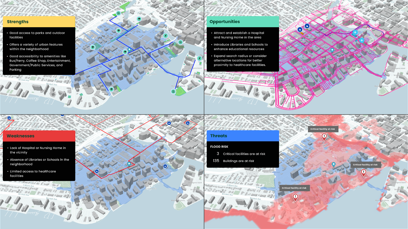
The defining characteristic of a functioning smart city is not the technology itself but the decision pipeline it feeds. Technology that generates data without connecting to decisions that act on it does not produce ROI. According to McKinsey Global Institute's research on smart city applications, well-implemented smart city software solutions can reduce incidents requiring emergency services by 10-15%, reduce commute times by 15-20%, lower disease burden, and reduce carbon emissions, but only in implementations where data flows directly into operational decision-making frameworks.
For enterprise development firms and planning authorities, the operational definition is narrower. Smart city software solutions are platforms that improve the quality and speed of urban planning decisions, from site selection and development feasibility through to infrastructure investment prioritisation and neighbourhood performance monitoring.
Why Smart City Software Matters for Modern Planning Teams
Planning teams at the municipal and enterprise development level face a data paradox. Cities generate more data than ever before, but planning decisions are often made with less structured information than the available data could support. Traffic counts, building energy performance data, demographic shift patterns, infrastructure condition assessments, and environmental quality measurements exist in separate departmental databases, accessed by different teams using incompatible tools, and rarely assembled into a coherent picture at the point where planning decisions are made.
Smart city software solutions address this by providing a unified analytical environment. Geospatially referenced, temporally current, and accessible to planning professionals without specialist GIS or data science skills. This matters for three specific planning functions.
- Site analysis: understanding the infrastructure capacity, environmental performance, demographic profile, and connectivity patterns of a development site before committing to an acquisition decision.
- Infrastructure investment planning: prioritising capital investment in roads, utilities, and public space based on evidence of where demand is highest and assets most degraded.
- Performance monitoring: tracking the post-occupancy performance of completed development against design intent, providing feedback loops that improve future planning decisions.
Top 7 Smart City Software Solutions for Planning and Development Teams in 2026
The smart city platform market encompasses tools at different scales and for different user profiles. The following are the leading categories and examples in current enterprise use:
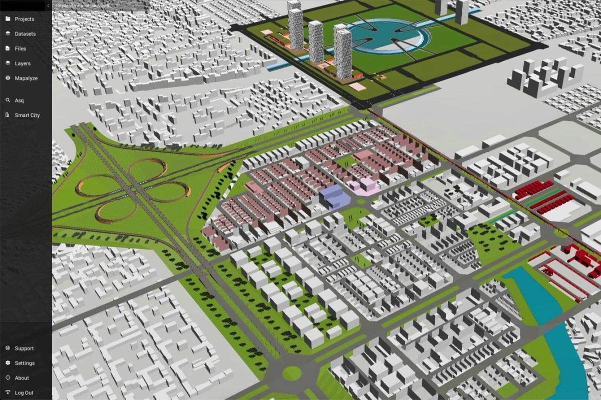
1. Digital Blue Foam Urban Insights: AI-driven urban planning platform covering city-level to plot-level analysis with integrated geospatial, climate, and demographic data. Suited to development feasibility, masterplan design, and sustainability performance analysis at enterprise and municipal scales.

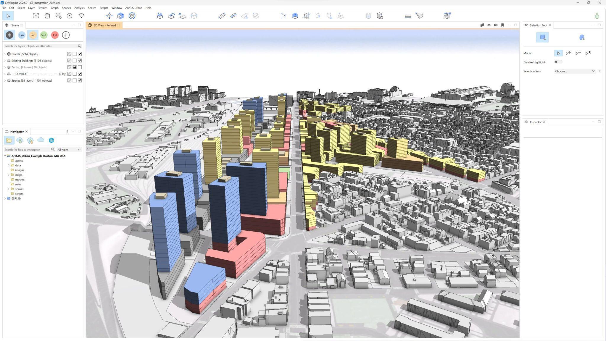
2. Esri ArcGIS Urban: GIS-based urban planning tool providing 3D city modelling, zoning scenario analysis, and development capacity mapping. Widely used by planning authorities for regulatory and compliance workflows.
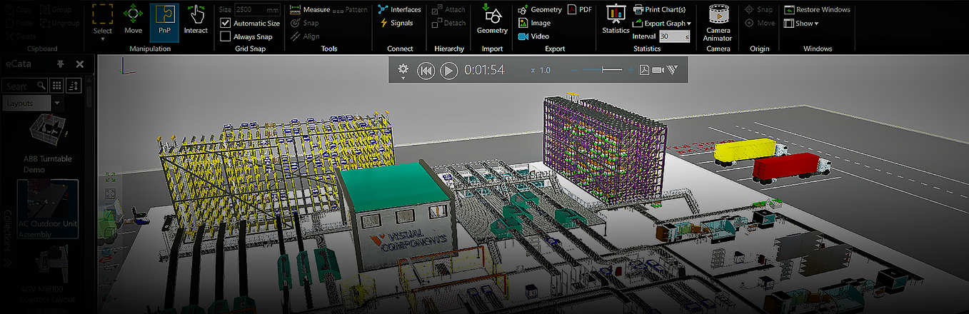
3. Cityzenith SmartWorldPro: Digital twin platform aggregating real-time IoT sensor data, building energy performance, and urban mobility data into a unified 3D city model. Suited to infrastructure operations and performance monitoring.
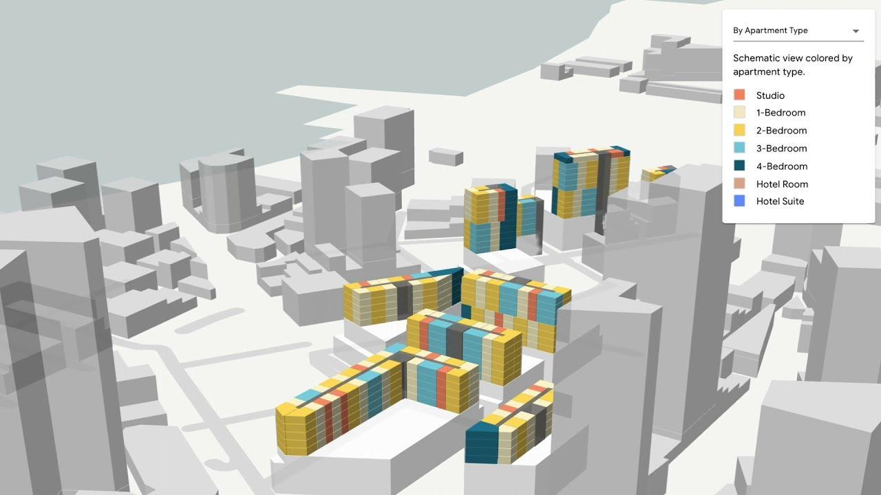
4. Sidewalk Labs Delve (now integrated with Autodesk): AI generative design tool for residential neighbourhood planning, optimising layouts against metrics including solar access, walkability, and cost per unit, primarily for residential masterplan applications.
5. IBM Intelligent Operations Center: Enterprise operational platform for city services management, integrating data from multiple city systems, including traffic, utilities, and emergency services, into a single operational dashboard.
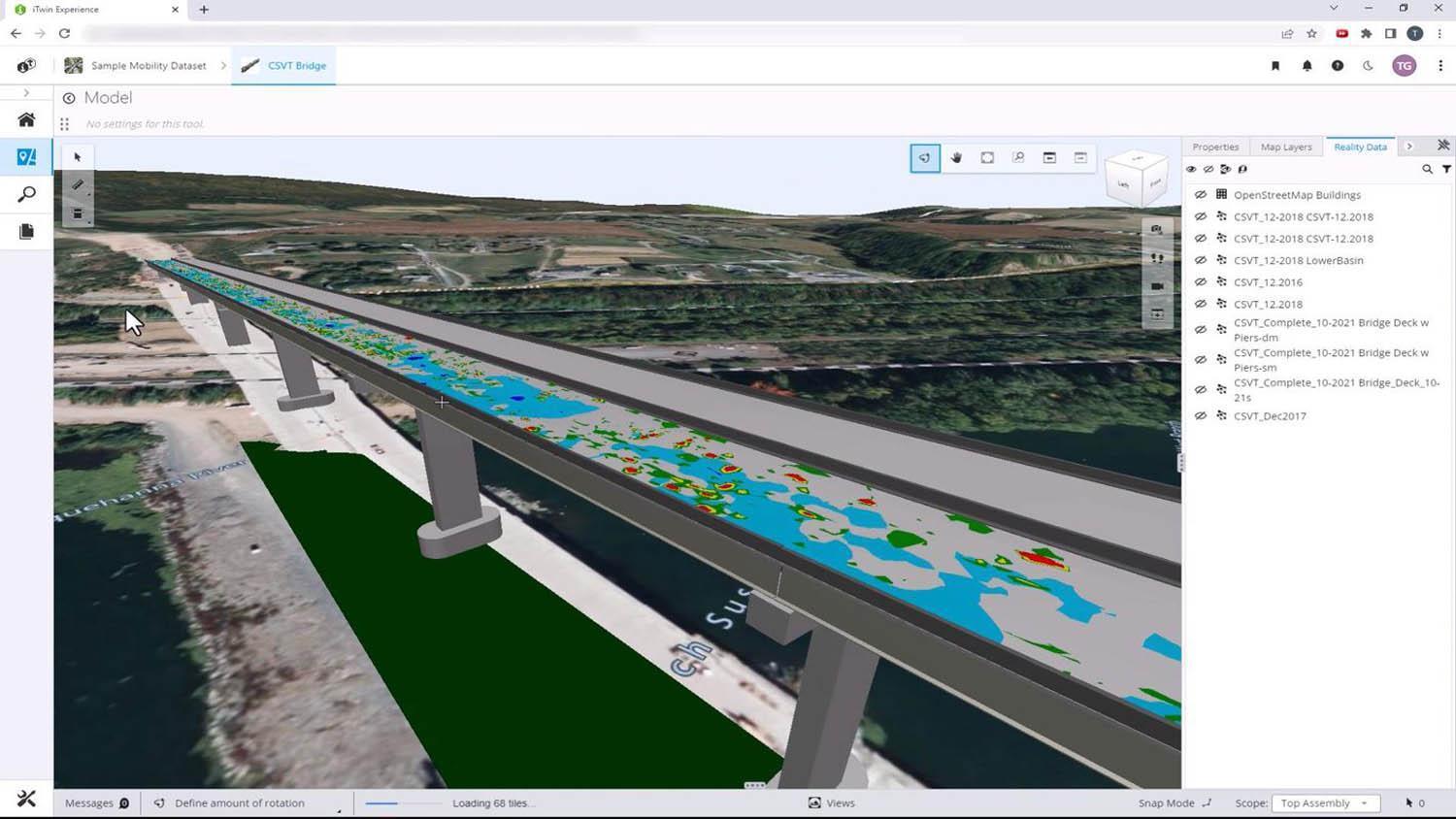
6. Bentley Systems iTwin: Infrastructure digital twin platform for monitoring and managing roads, rail, water, and building infrastructure assets using real-time sensor data and predictive analytics.
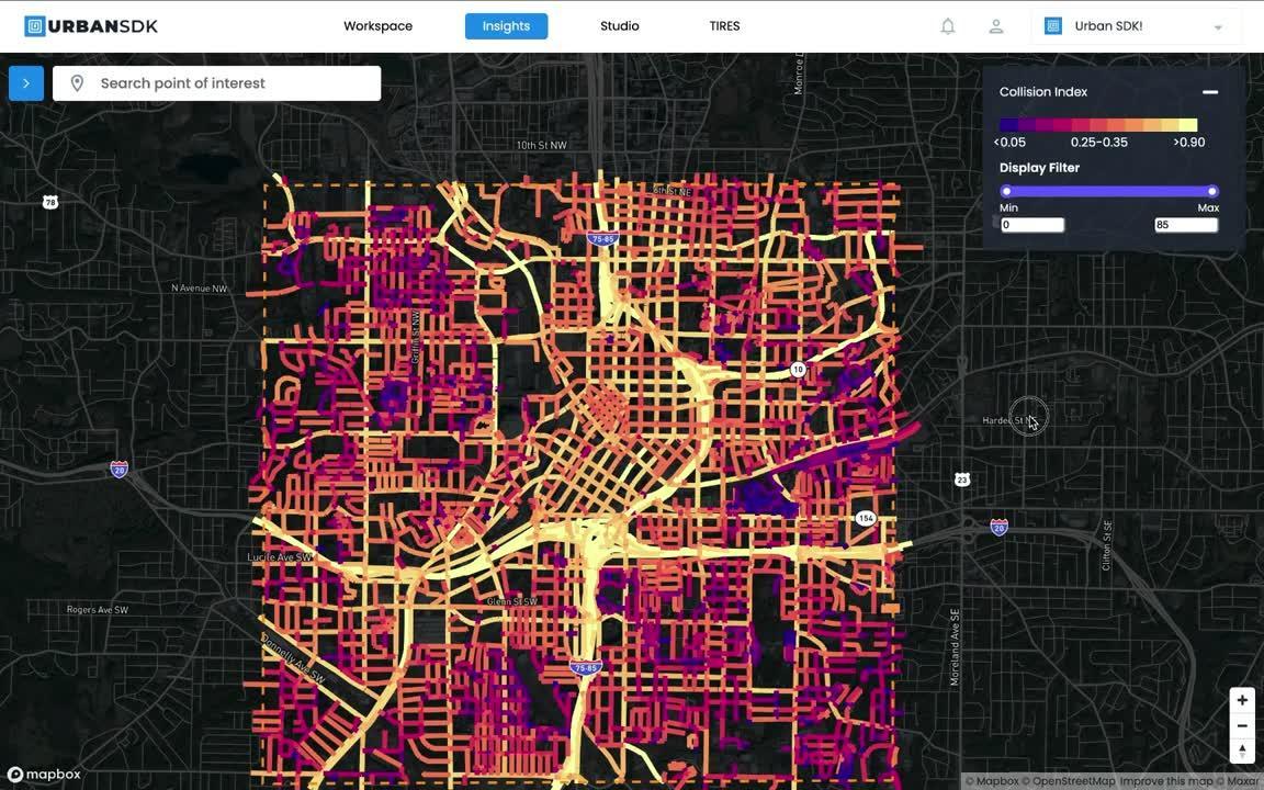
7. Urban SDK: Data analytics platform providing mobility analysis, land-use performance measurement, and development impact modelling for planning authorities and transportation agencies.
Key Challenges in Traditional Smart City Approaches
The pattern of smart city implementations that fail to deliver ROI is well documented. The common failure modes are not primarily technical; they are structural and procurement-driven.
The first failure mode is technology-led procurement. Organisations that select smart city software solutions based on technology features rather than defined operational use cases inevitably acquire platforms that are technically impressive but organisationally disconnected. The question that should precede any smart city procurement is not 'what does this platform do?' but 'which decisions would we make differently if we had better data, and how frequently do we make those decisions?' Only when that question has a concrete answer can ROI be credibly evaluated.
The second failure mode is data siloing within a smart city programme. Many municipal smart city implementations involve multiple vendors providing separate platforms for traffic management, energy monitoring, environmental sensing, and public safety. Without a data integration layer that connects these platforms, the city ends up with multiple dashboards rather than a unified operational picture, and the burden of manual data assembly falls on already under-resourced planning teams.
The third failure mode is the absence of a feedback loop between the smart city platform and the planning process. Technology that monitors what a city does without connecting to the decisions about what the city will do next is retrospective rather than strategic. The smart city platforms that deliver sustained ROI are those embedded in planning workflows, informing development decisions before commitments are made, not just monitoring outcomes after the fact.
How AI and Spatial Analytics Are Transforming Smart City Platforms
The current generation of AI-integrated smart city software solutions is shifting the value proposition from monitoring to prediction. Rather than simply reporting what is happening in a city, AI-native platforms use historical data patterns to project how conditions will evolve under different development and policy scenarios, giving planning teams a forward-looking analytical capability that retrospective monitoring systems cannot provide.
For urban development teams, the most significant application of this capability is development impact modelling. Before committing to a planning application, a developer can model the projected impact of a proposed development on local infrastructure capacity, traffic levels, and environmental quality, using the city's live data as the baseline. This evidence is increasingly required by planning authorities in major cities as a condition of pre-application engagement, and AI-native platforms make it practical to produce at the early design stage rather than as a late-stage consultant study.
Geospatial AI also enables a quality of site analysis that was previously accessible only to organisations with specialist GIS teams. An enterprise development firm can evaluate the micro-mobility patterns, retail footfall data, environmental quality, and infrastructure capacity of multiple potential acquisition sites simultaneously, building an evidence base for investment decisions that would previously have required months of manual data assembly. Unlike manual data aggregation processes that produce a static snapshot, AI-integrated platforms update this analysis as new data becomes available, keeping the evidence base current.
How Digital Blue Foam Supports Smart City Planning Workflows
Digital Blue Foam's Urban Insights platform is designed for the precise use case that most smart city software solutions fail to serve: integrating geospatial, climate, and demographic data directly into the urban planning and development decision workflow. The platform covers city-level through to neighbourhood and plot-level analysis, allowing planning teams to move from strategic land-use decisions down to site-specific feasibility analysis within a single environment.
For municipal planning authorities, DBF Urban Insights provides a data-informed basis for development feasibility assessment, infrastructure investment prioritisation, and sustainability performance tracking, all within a platform accessible to planners without specialist GIS skills. For enterprise development firms, the platform supports site selection, development option evaluation, and planning submission preparation with integrated geospatial evidence.
The platform's integration of climate data, demographic trends, and built environment analysis makes it particularly relevant for planning teams working in high-growth or climate-stressed urban environments, where the consequences of uninformed development decisions play out quickly and at a significant scale.
Explore DBF's capabilities for smart city planning and development. Visit Digital Blue Foam's platform overview for the full suite of urban planning capabilities.
Best Practices for Smart City Software Implementation
The organisations that achieve sustained ROI from smart city software investments share a procurement and implementation discipline that technology-first buyers typically lack.
Start with the decision, not the data. Before selecting a platform, document the specific planning decisions that better data would improve, how frequently those decisions are made, and what the cost of making them with inadequate information currently is. This framework makes ROI calculation tractable and keeps implementation scope realistic.
Invest in data governance before data volume. A smart city platform is only as valuable as the quality, currency, and accessibility of the data it runs on. Organisations that invest in data governance — standardise data formats across city systems, establish update frequencies, and define data ownership — before scaling their smart city platform deployment consistently outperform those that prioritise feature breadth over data quality.
Define success metrics before go-live. Smart city implementations that cannot demonstrate ROI within 12 months typically fail to define what success looks like before deployment. Decision cycle time, data assembly hours per planning application, infrastructure investment optimisation, and carbon emissions reductions are all measurable KPIs that should be baselined before implementation and tracked against post-deployment.
Conclusion
Smart city software solutions deliver ROI when they are connected to decisions that matter, not when they are deployed as technology showcases. The platforms that are generating measurable value for planning authorities and enterprise development organisations in 2026 share a common characteristic. They are embedded in the planning workflow rather than parallel to it, feeding quantified evidence into decisions at the point where that evidence can change outcomes.
For planning directors and municipal technology leaders evaluating smart city investments, the evaluation framework is straightforward. Which decisions would this platform improve? How frequently are those decisions made, and what is the cost of current decision-making quality? If those questions have concrete answers, ROI is calculable. If they do not, the platform is a risk rather than an investment.
To see how Digital Blue Foam's Urban Insights platform supports data-driven planning and development decisions at city and portfolio scale, book a demo or explore the platform.
FAQs
What are smart city software solutions?
Smart city software solutions are digital platforms that aggregate, analyse, and visualise urban data — from traffic flows and energy consumption to demographic trends and environmental quality — to improve the quality and efficiency of urban planning and management decisions. For enterprise development firms and planning authorities, the most relevant smart city platforms integrate geospatial, climate, and infrastructure data directly into the planning workflow, enabling evidence-based site selection, development feasibility analysis, and infrastructure investment prioritisation.
How do smart city platforms generate ROI?
Smart city platforms generate ROI through three primary mechanisms: reducing the time and cost of data assembly for planning decisions, improving the quality of investment and development decisions by providing more comprehensive evidence, and enabling proactive rather than reactive infrastructure management. McKinsey's research suggests well-implemented smart city platforms can reduce emergency response times by 10-15% and commute times by 15-20%, translating into calculable savings in operational costs and productivity for city administrations.
What is the difference between a smart city platform and a GIS tool?
Traditional GIS tools such as Esri ArcGIS are primarily mapping and spatial data management platforms. They organise and display geospatial information but require significant specialist configuration to support specific analytical workflows. Smart city software solutions are application-layer platforms built on geospatial data infrastructure, designed for operational use by planning professionals without specialist GIS skills. They typically include pre-built analytical modules for development feasibility, infrastructure planning, and performance monitoring that GIS tools require custom development to replicate.
How should a planning authority evaluate smart city software?
Planning authorities should evaluate smart city software against three criteria: decision relevance (does the platform provide data that directly informs the decisions the authority makes most frequently?), integration capability (can the platform connect to the city's existing data systems without prohibitive integration cost?), and user accessibility (can planning professionals use the platform effectively without specialist GIS or data science training?). Feature richness is a secondary consideration; operational fit is primary.
Can smart city platforms integrate with existing planning and BIM systems?
Yes, leading smart city platforms are designed with integration APIs that connect to common planning management systems, BIM environments, and municipal data infrastructure. The critical integration question is data format compatibility: smart city platforms that consume open standard formats (GeoJSON, IFC, CityGML) are significantly easier to integrate with existing city systems than those requiring proprietary data pipelines. Enterprise organisations should require documented API specifications and existing integration case studies as part of procurement evaluation.
