
Global Car-Free Development Case Studies for Enterprise Planning Teams
Car-free development often enters planning conversations as a bold idea or as an aspirational goal. But it is not just theory. Around the world, there are full-scale urban districts where private cars are restricted or simply impossible to use, providing enterprise planning teams with working laboratories for rethinking mobility, land use, infrastructure, logistics, and regulation. · June 2, 2026


Car-free development often enters planning conversations as a bold idea or as an aspirational goal. But it is not just theory. Around the world, there are full-scale urban districts where private cars are restricted or simply impossible to use. For enterprise planning teams, these are not curiosities to glance at and forget; they are working laboratories for rethinking mobility, land use, infrastructure, logistics, and regulation.
The most valuable lessons rarely come from a weekend pedestrian plaza or a one-off street closure. They come from substantial, long-established areas that have operated without private-car dominance for decades, and sometimes centuries. Looking at how these places are governed, how services are organized, and how people actually move through them reveals practical approaches to:
- Transit-oriented masterplanning
- Lowering parking requirements
- Re-engineering freight and last-mile delivery
- Designing public spaces that nurture social life
- Building long-term infrastructure resilience
Largest Car-Free Urban Areas Worldwide
1. Venice, Italy
Approximate Size: ~7.6 km² (historic island core) | Resident Population: ~50,000 (historic center), with millions of annual visitors
Venice is perhaps the most immediate example. A stitched-together archipelago of islands where streets are canals and bridges, and public life unfolds on foot and by boat.

Mobility Model: Walking and water-based transport as the default, public water buses (vaporetti), freight and service delivery executed by specialized boats, and no internal road-based circulation.
Enterprise Lessons: Venice demonstrates that car-free systems can handle both resident life and massive tourism flows. Concrete takeaways include centralized freight logistics organized around canalside consolidation points, a pedestrian network that doubles as the primary circulation system, and emergency services and response strategies adapted to waterborne access. When infrastructure is designed around non-vehicular access, you can effectively rebuild mobility from the ground up.
2. Fes el-Bali, Morocco (Medina District)
Approximate Size: ~2.5 km² | Resident Population: ~150,000
Fes el-Bali is one of the largest contiguous car-free zones anywhere. Its alleys are so narrow that cars are structurally excluded. Daily life plays out at a human scale among markets, courtyards, and workshops.

Mobility Model: Pedestrian circulation, handcarts and animal transport for goods, and vehicles confined to the perimeter.
Enterprise Lessons: Fes grew slowly rather than being engineered, and that organic development teaches important lessons: high-density, mixed-use clustering that keeps most trips short, micro-commerce embedded directly into the walkable fabric, and lower infrastructure footprints because of compact block patterns. For modern development, the medina suggests how compact geometry can yield carbon and cost efficiencies.
3. Ghent, Belgium (Car-Free City Center Model)
Approximate Size (restricted zone): ~35 hectares central core | City Population: ~260,000
Ghent's shift was deliberate and policy-driven. Rather than imposing an immediate ban, city leaders rerouted traffic, closed through-roads, and phased changes while engaging residents and businesses. The result is a center where walking and cycling predominate and transit is well integrated.
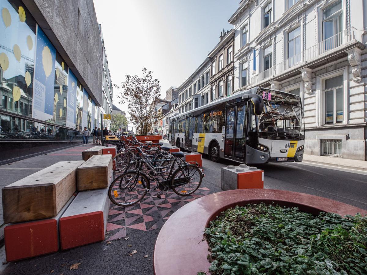
Mobility Model: Pedestrian and bicycle priority in the core, restricted through-traffic with circulation loops, and tram and transit integration.
Enterprise Lessons: Ghent offers a practical governance playbook: re-routing traffic as an alternative to outright bans, phased rollouts combined with clear ongoing communication, retail and economic indicators that stabilized or improved, and significant shifts toward cycling and public transit. This model is useful for mid-sized cities wanting to curb car dominance without harming local economies.
4. Mackinac Island, USA
Approximate Size: ~10.3 km² (entire island) | Resident Population: ~500 permanent residents (large seasonal tourism spikes)
Mackinac Island banned motor vehicles in 1898. Today it functions on foot, bicycle, and horse-drawn carriage. A compact, enduring car-free system centered on tourism.
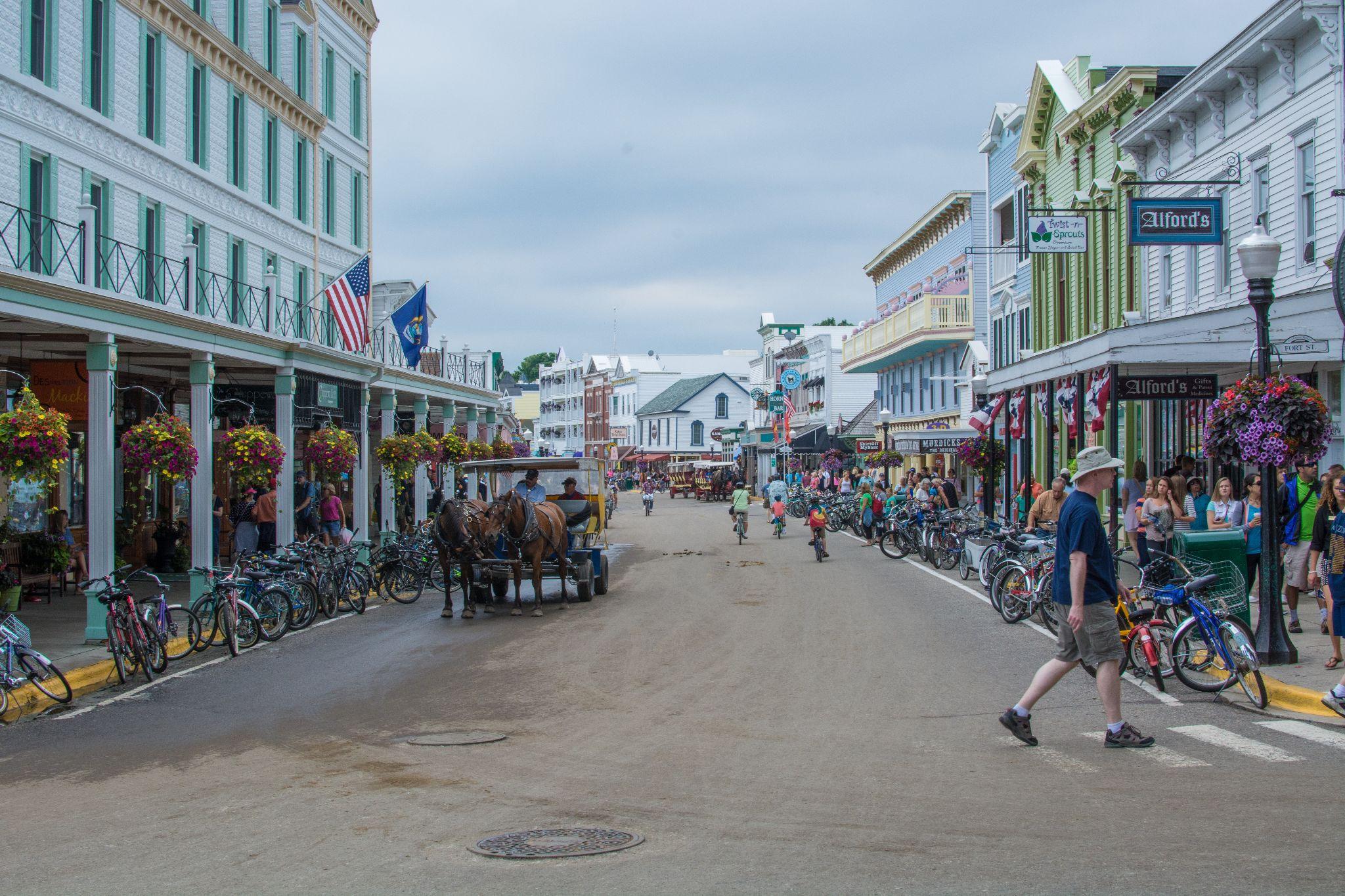
Mobility Model: No private motor vehicles, bicycle networks and horse transport, and controlled logistics for supplies and services.
Enterprise Lessons: Though modest in scale, Mackinac illustrates long-term viability where tourism is central: clear branding tied to a car-free identity, simpler infrastructure and lower maintenance complexity, and a distinctive visitor experience that supports local businesses. A useful template for resort-scale or island masterplans.
5. Hydra, Greece
Approximate Size (settlement core): ~2 km² | Resident Population: ~2,000
Hydra forbids private cars and motorbikes in the main settlement, producing a slow-moving, pedestrian-first town where donkeys and water taxis remain part of everyday life.
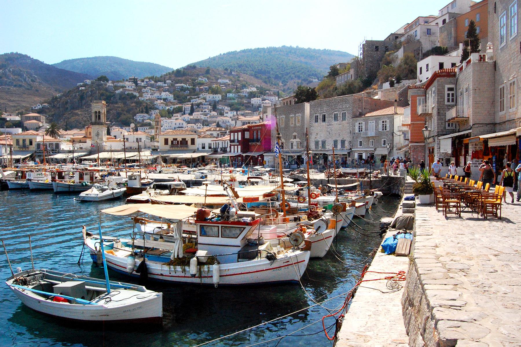
Mobility Model: Dominance of pedestrian pathways, animal transport for goods, and water taxis for regional connectivity.
Enterprise Lessons: Hydra shows that topography plus firm enforcement can sustain a car-free status without huge capital outlays. Tourism and property markets often thrive, and residents frequently cite the quiet, walkable character as a major quality-of-life benefit.
6. Zermatt, Switzerland
Approximate Size (village core): ~5 km² | Resident Population: ~5,800
Zermatt restricts combustion-engine vehicles and permits limited electric shuttles for essential logistics. Rail is the main arrival mode, and most streets are pedestrianized.
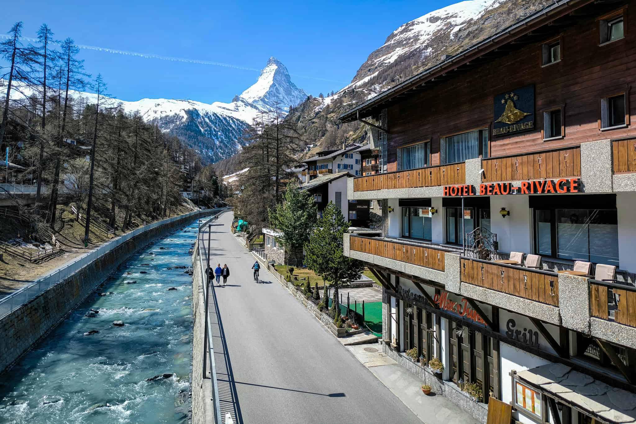
Mobility Model: Electrified service vehicles for necessary tasks, rail as primary access, and pedestrian-first village streets.
Enterprise Lessons: Zermatt functions as a hybrid model tailored to alpine resorts: controlled electrified mobility for essential services, strong rail connectivity that reduces car dependence, noticeable air-quality and amenity gains, and premium positioning for real estate and hospitality.
Comparative Enterprise Takeaways
Across these cases, a few consistent patterns emerge:
- Perimeter vehicle management — keeping cars at the edges is practical and common.
- Freight and last-mile logistics must be rethought with consolidation and alternative modes in mind.
- High-density, mixed-use development materially reduces trip demand.
- Clear governance, enforcement, and community engagement are essential.
- Viable, reliable mobility alternatives must be in place before restricting cars.
Many of these districts evolved organically rather than from modern master plans, yet they prove that vehicle-restricted systems can support permanent populations, tourism economies, vibrant retail, and resilient infrastructure. The key question for enterprise teams is not whether car-free districts can work, but how to translate their structural principles into contemporary, scalable development projects.
Analysis of Success Factors
The world's most notable car-free urban districts come from very different places, geographically, historically, and economically. These neighborhoods do not succeed by accident; they rely on the alignment of infrastructure, enforceable rules, and changes in how people and goods actually move.
Common Structural Characteristics
1. Compact urban form
Car-free districts work because everything is nearby. Homes, shops, workplaces, and services cluster so walking becomes the easiest, most obvious choice. Short blocks and a dense pedestrian grid, few superblocks to interrupt movement, and small or no setbacks from the street. Tighter geometry reduces travel demand before you even start phasing out cars.
2. Perimeter vehicle containment
Even places that ban cars at their cores still allow tightly controlled access at the edges: drop-off points and edge parking, rail or ferry terminals, and freight consolidation zones. Inside the core it is vehicle-free; at the boundary, activity is managed. For enterprise developments, this is one of the most transferable tactics.
3. Mobility substitution before restriction
The successful examples put alternatives in place first, then remove cars. High-quality transit in Ghent and Zermatt, water transport in Venice, bike dominance on Mackinac, and dense walkable streets in Fes. Simply banning cars without replacements usually breaks local economies.
Infrastructure Patterns
Reduced roadway width and material intensity
When streets are not built for private cars, they are narrower. Less asphalt means lower pavement and maintenance costs, reduced stormwater runoff, and smaller urban heat islands. For enterprise teams, this translates into lower embodied carbon and smaller capital bills.
Distributed micro-logistics systems
Goods delivery can be decentralized through small electric vans or carts, cargo bikes, and consolidation hubs at the edge. Modern plans mirror this with last-mile hubs and time-windowed service corridors.
Public spaces as circulation infrastructure
In car-free districts, public spaces double as streets. Investment shifts from vehicle throughput to placemaking and accessibility, changing budgets and program priorities.
Strong governance mandates
Whether through bans (Hydra, Mackinac), traffic reforms (Ghent), or environmental protection (Zermatt), enforceable rules are necessary. Without clear enforcement, policy corrodes.
Parking supply control
Controlling parking is central. Internal parking should either be eliminated or tightly limited, permit restrictions enforced, and consolidated perimeter parking maintained. Lose parking controls and the car-reduction goals leak away.
Phased transition strategies
Gradual change reduces backlash. Ghent's approach — reroute traffic, monitor, tweak, then make measures permanent — shows the value of phasing. It gives people and businesses time to adapt.
Cultural and Contextual Factors
Historic evolution vs. modern retrofit
Venice and Fes evolved before cars; their narrow geometry inherently resists vehicles. Modern cities do not have that advantage and need deliberate restructuring. Planners must separate what is historically ingrained from what can be engineered.
Tourism vs. permanent urban economy
Some car-free places lean heavily on visitors (Zermatt, Hydra, Mackinac). That model does not translate cleanly to cities with diversified employment. Ghent shows you can pedestrianize within a working urban economy, but it requires reliable transit, dense retail clusters, and integrated employment centers.
Economic and social acceptance
Over time, residents in many car-free districts report cleaner air, safer streets, and more usable public spaces. Retail often stabilizes or improves once people accept new flows. The long game is behavioral normalization — infrastructure matters, but so does making the new normal feel normal.
Scalability Lessons for New Developments
What Can Scale?
1. Perimeter parking + internal pedestrian core
This is practical for masterplanned communities, resorts, university campuses, and innovation districts. Parking facilities can be kept at the edge while the center remains walkable. This is operationally straightforward.
2. Transit-oriented density clusters
When density is concentrated around rail or BRT, internal car dependence drops. This scales for mid- to high-density projects where frequent transit is viable.
3. Mixed-use proximity planning
Putting everyday needs within a 5–10 minute walk is broadly replicable. Retail, schools, clinics, and parks should be woven into the fabric.
4. Micro-mobility integration
Cargo bikes, electric shuttles, and shared hubs can scale well. Modern logistics tech can make last-mile freight more efficient than older, larger-vehicle systems.
What Does Not Scale Easily?
1. Complete vehicle prohibition in large metro contexts
Wiping out cars across an entire metro is hard unless you already have strong transit everywhere. Hybrid or phased car-lite models are more realistic.
2. Tourism-dependent models
Places built mainly for visitors do not map cleanly onto cities that need functional mobility for workers and supply chains.
3. Organic medieval geometry
You can admire narrow, winding medieval streets, but you cannot simply insert them into contemporary codes without trade-offs. Safety, emergency access, and service delivery standards matter.
Adaptation Strategies
Rather than all-or-nothing, planners can consider:
- Gradual parking-reduction targets
- Transit-first phasing
- Shared mobility partnerships
- Freight consolidation and scheduled deliveries
- Electric vehicles for essential services
Hybrid approaches like Zermatt's electric-only inner mobility offer practical, politically viable transition pathways. Scalability depends on population density, transit frequency and reliability, economic mix, and governance capacity. When transit is easier and quicker than driving, people switch. That is the operational goal.
Implementation Roadmap
Large projects benefit from a phased roadmap.
Phase 1: Feasibility and Baseline Assessment
Start by proving the idea will actually work — technically and economically. Key actions include: analyzing mobility demand, mapping parking dependency, assessing freight and service access needs, evaluating public transit capacity, and reviewing regulatory constraints. Run multiple scenario models at this stage. Harness the power of spatial analytics and digital twins to give planners a comprehensive understanding of how people move, how density stresses systems, and how flows change before a single curb is altered.
Phase 2: Concept Masterplanning and Infrastructure Structuring
Decisions to lock in now include: where perimeter parking and access nodes sit, a pedestrian-first street hierarchy, cycling and micro-mobility corridors, freight consolidation hub locations, and transit corridors aligned with density clusters. Street geometry and block layout must support the mobility hierarchy you want. AI-assisted planning tools like Digital Blue Foam test density, movement performance, and infrastructure fit in the first design pass.
Phase 3: Policy Alignment and Regulatory Integration
A car-free district needs enforceable rules to last. Planners need to address parking ratio changes, zoning updates, traffic circulation laws, delivery time windows, and environmental compliance. Clear, durable policy prevents a slow slide back to car dependence. Governance is infrastructure too — as important as pavement and poles.
Phase 4: Stakeholder Engagement and Communication
Most resistance springs from fear of losing access. Best practices include: sharing the data openly, running pilot demonstrations (temporary bollards, pop-up plazas), phasing changes so impacts are gradual, delivering visible public-realm improvements early, and providing business-continuity assurances. People adapt when they experience better places, not just promises. Ghent's phased rollout is a useful example: tangible upgrades to sidewalks and squares shifted behavior because the benefits were visible and immediate.
Phase 5: Phased Implementation and Monitoring
Successful districts rarely slam the gates shut overnight. Rollouts typically move in stages: traffic rerouting, parking reduction, expanded pedestrian zones, and full internal restriction. Monitor mobility patterns, retail footfall, and congestion continuously. Use dashboards that fuse spatial and transport data for near-real-time oversight.
Economic Impact Analysis
Property Value Trends
Walkable, pedestrian-first places tend to become more desirable to residents, command higher market prices, enjoy lower noise and cleaner air, and offer a richer public realm. Across many European cities, properties within pedestrian cores outperform those in car-oriented peripheries over long horizons. For developers, a well-crafted public realm becomes a value multiplier.
Business Performance
Retailers initially worry about losing drive-by trade. But evidence — again, Ghent is instructive — shows retail performance stabilizes or improves after implementation. Contributing factors include longer pedestrian dwell times, better storefront visibility, a more inviting street experience, and less congestion-related stress. Retail clusters do best when car reductions are paired with reliable transit and a logistics plan for deliveries.
Tourism Effects
Places such as Venice, Zermatt, Hydra, and Mackinac Island show that being car-free can itself be an attraction. Cleaner air, greater safety, and a distinct identity strengthen destination appeal. Resorts and mixed-use developments can use a car-free brand as a competitive edge.
Long-Term ROI Considerations
Car-free approaches can lower road maintenance budgets, pavement replacement cycles, traffic-management hardware needs, and stormwater management costs. Less infrastructure intensity reduces capital needs and embodied carbon. Added benefits include alignment with ESG goals while opening access to green financing, and reduced exposure to future carbon rules. Properly engineered, car-free strategies are not anti-growth — they reallocate capital from vehicle throughput toward place-making and durable assets.
Conclusion and Next Steps
Large car-free districts worldwide show vehicle reduction at scale is possible in many contexts, from historic islands to modern masterplans. The consistent principles are straightforward: compact, mixed-use geometry; perimeter vehicle containment; strong transit or alternative mobility options; clear regulations; and phased implementation.
For enterprise teams, the aim is not to copy a model verbatim but to adapt these principles to the project's context. New developments have an advantage: you can bake mobility hierarchy, parking reduction, density, and sustainability into the first design iteration. Treat car-free development as systems design — combining spatial analytics, policy, engineering, and stakeholder work — and you are far more likely to create a resilient, high-performing district. As climate targets tighten and urban land values rise, car-free and car-lite approaches will move from niche experiments toward mainstream practice. Teams that model, test, and act now will shape the next generation of urban places.
