
Enterprise Masterplanning Guide for Car-Free Urban Development Projects
What was initially a simple pedestrianization project in town centers across Europe has turned into a comprehensive, continent-spanning strategy for rethinking urban mobility. The roots of this movement date back to the late 20th century, but it's only now, after decades of development, that we're starting to see a significant shift away from merely mitigating the problems associated with cars, such as pollution and congestion, to a much more systemic, city-wide overhaul. · June 2, 2026


The Evolution of the Car-Free Cities Movement
What was initially a simple pedestrianization project in town centers across Europe has turned into a comprehensive, continent-spanning strategy for rethinking urban mobility. The roots of this movement date back to the late 20th century, but it's only now, after decades of development, that we're starting to see a significant shift away from merely mitigating the problems associated with cars, such as pollution and congestion, to a much more systemic, city-wide overhaul.
In the early days, cities were primarily focused on responding to the issues caused by cars, including pollution, congestion, and a decline in quality of life. But over time, things have changed. Today, we see cities like Amsterdam and Copenhagen showing the world that if you put the needs of pedestrians and cyclists first, you can actually reduce congestion and improve public health and the local economy, too. Then there's Barcelona with its superblocks - a whole new way of thinking about how to reorganise space to reduce car use. Paris has taken it a step further with its 15-minute city concept, which makes sure that everything is within easy walking distance. And in Freiburg's Vauban district, the whole idea of building a new development was done with the goal of minimising car use from day one.
These days, a 'car-free city' isn't just about not having any cars. It's about how you use the space, capital, and rules in the city to make life better for pedestrians, cyclists, and public transport users. It's not just driven by things like climate change, although those are important factors; it's also about how people are changing the way they live and work, and becoming much more critical of urban planning that's dominated by cars.

For the companies that develop and build these places, the idea of car-free living is both a big opportunity and a major headache. On one hand, you can save a lot of money on parking, free up a lot of land for other uses, and make your assets a lot more valuable in the long run. On the other hand, getting it right is incredibly complex - you need to make sure that you're working well with all the different stakeholders, that you've got the right zoning rules, that your transport system is properly sorted out, and that you're rolling out the new infrastructure bit by bit.
So before you even think about trying to turn a car-free vision into a practical masterplan, you need to get a pretty good idea of what you're trying to achieve and where your city or development fits in with the ideas that other people are trying out.
What Makes a Car-Free City?
You hear the term 'car-free city' thrown around a lot, but it's actually a pretty vague term. The reality is that no city is completely free of cars - what you tend to see is different districts or areas where cars are given different levels of access and priority.
At its core, a car-free district is one where you give priority to pedestrians, cyclists, and public transport over private cars. You can see that in the way the place is designed, the rules it has, and the way that money is spent on infrastructure. The key features generally include:
- Limited or no access for private cars in certain areas
- Less parking available
- A dense network of buses and trains
- Good, continuous paths for pedestrians and cyclists
- A mix of different uses for land that should reduce the need for people to travel so far
- Emergency vehicles get to where they need to go, but it's all carefully controlled
The thing is, a truly car-free district doesn't get rid of mobility altogether - it just sorts out how it works in a different way.
Spectrum: Car-Lite to Car-Free
Enterprise developers need to understand the four levels of car-free construction to position their developments within the current regulatory and market constraints.
1. Car-Dominant (Baseline Model)
In this model, all other modes of mobility are viewed as secondary. Road networks, parking, and other car-focused infrastructure are the primary design components.
2. Car-Lite Urban Districts
Developments categorized as car-lite involve reducing parking, designing for transit first, blending thoroughfares for cars with pedestrians, and providing managed access for vehicles. In these models, internal roads can act as shared space.
Examples of this include:
- Portions of Paris with developing 15-minute districts
- Portions of Zurich with aggressive parking restrictions
Car-lite models present a low-risk starting point for a new enterprise development.
3. Restricted Circulation Models
In this model, vehicles can access the space, but there are no through routes for non-local vehicles. Internal roads are not designed for vehicles to use as shortcuts. Traffic circulation is designed to purposefully discourage non-local vehicle use.
Examples of this include:
- Ghent's traffic circulation plan
- Barcelona's Superblocks
This model can greatly reduce congestion without implementing a car ban.
4. Car-Free Districts
In this model, there is no access to private vehicles other than emergency-service or internal-service vehicles. Here, most parking is centered around periphery buildings.
Examples of this include:
- Venice (historic city center)
- Freiburg - Vauban District
- Certain blocks in Barcelona's Superblocks
Fully car-free districts require strong transit integration with dense and mixed-use programmed development.
Global Examples
There is a growing interest in designing car-free cities across the world.
Europe (Primary Locations)
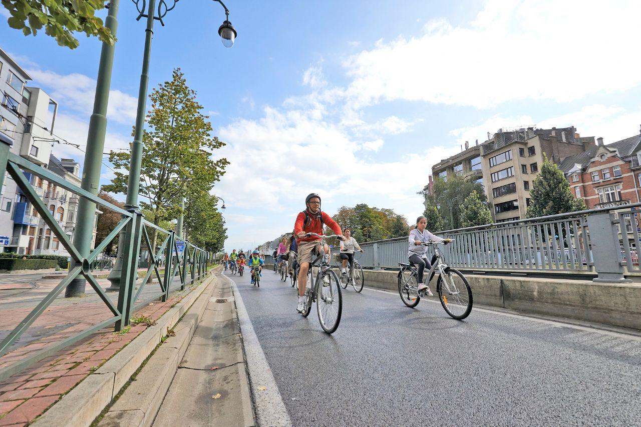
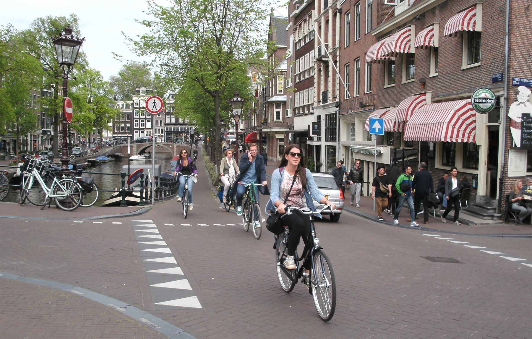
Amsterdam: A cycle-first, reduced-number-of-parking spaces approach
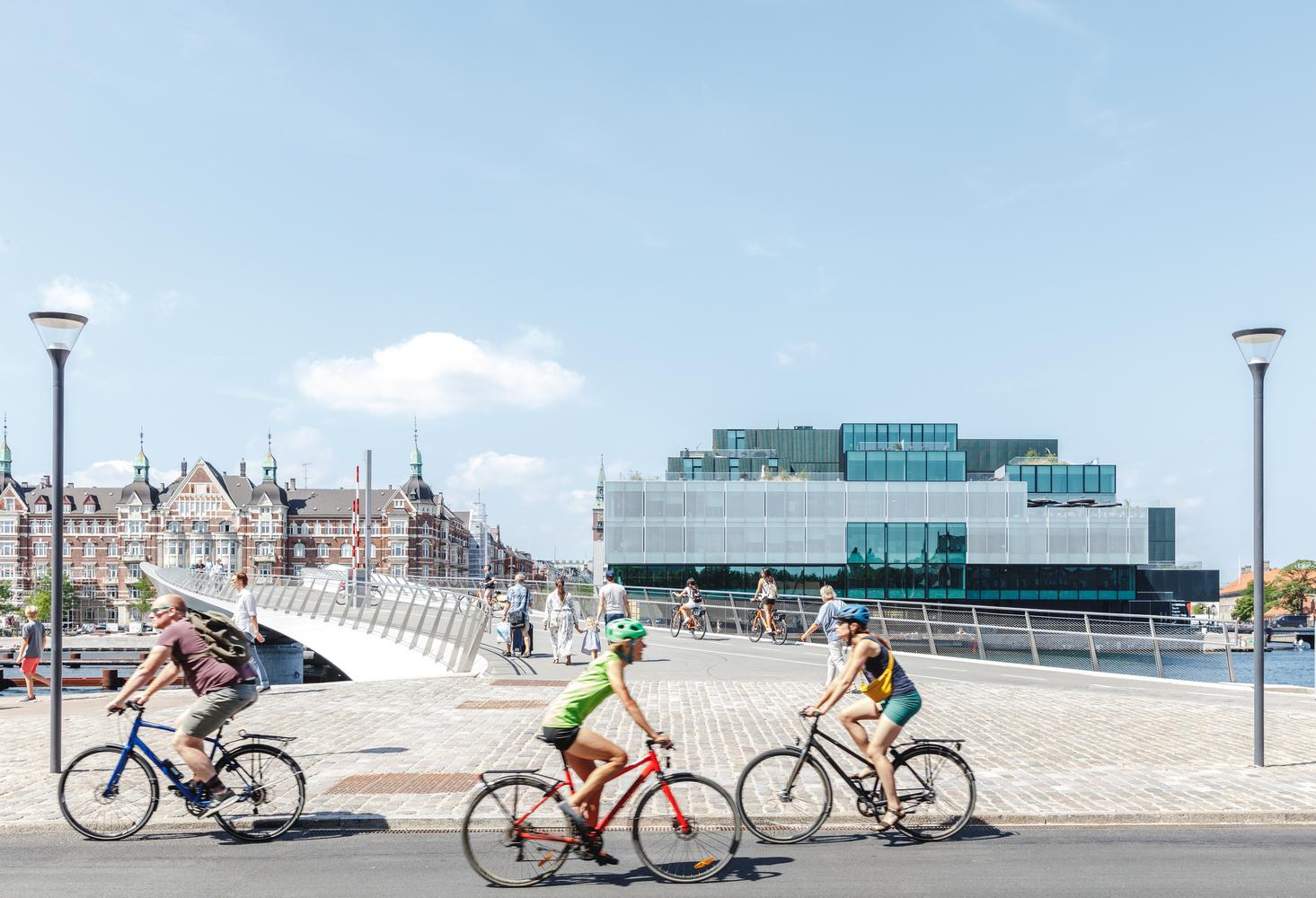
Copenhagen: A pedestrian-focused and public-space engineering approach
Barcelona: Block-scale "superblock" reorganization
Oslo: Systematic elimination of on-street parking areas

Asia
Singapore has introduced congestion pricing and identified transit-oriented developments. Masdar City (UAE): Has been designed as a "low vehicle" testing development district.
North America
A few selected car-free districts on major campuses. Transit accessible master planned districts with reduced parking requirements.
These examples demonstrate that designing "car-free" communities need not be a binary decision; they are adaptable across regulatory frameworks, density levels, and cultural contexts and will result in completed car-free projects worldwide.
Key Distinction: Car-Free vs. Car-Reduced
The primary difference between car-free areas and car-reduced areas in enterprise masterplanning is determining which condition ideologically applies to the initial phases of masterplanning. Total elimination of cars will not be possible during the initial phases, but developers can incorporate:
- Reduced parking ratios
- Integrating mobility hubs
- Decentralizing internal streets
Enterprise-scale car-free development should be viewed as a strategy for improving mobility rather than as a policy that restricts transportation. Car-free cities are not defined by a lack of cars. Instead, they are characterized by better alternatives and efficient land use.
Masterplanning Principles for Car-Free Development
Car-free urban development cannot succeed through policy alone. It must be integrated into the plan from the earliest design stages. Successful car-free districts work because they consider mobility systems, land use, population density, and environmental infrastructure as part of a unified framework, not just separate elements.
Mobility Hierarchy Design
The main feature of a car-free masterplan is a well-defined mobility hierarchy. Traditional car-centric developments focus on vehicle movement at the top of this hierarchy. Car-free masterplanning flips this structure.
A typical car-free mobility hierarchy prioritizes:
- Pedestrians
- Cyclists and micro-mobility users
- Public transit
- Service and emergency vehicles
- Private vehicles (limited or peripheral access only)
Implementing this hierarchy requires physical, regulatory, and operational support. Street widths must prioritize pedestrians over vehicles. Block sizes should enhance walkability, and intersections must reduce points where vehicles and non-motorized users might conflict. Transit infrastructure needs to be located centrally and visible in public spaces instead of being placed at the edges of districts. Mobility hubs that combine shared bicycles, electric scooters, car-share services, and transit ticketing improve overall system efficiency.
A successful hierarchy makes walking the most convenient choice for short trips, public transit the preferred choice for medium trips, and private vehicles the least convenient.
Mixed-Use Integration Strategies
Car-free districts must limit unnecessary trips, which can only happen through thoughtful mixed-use integration. Areas that are solely residential or solely commercial lead to greater reliance on external mobility options, which undermines the goal of reducing car use.
Effective mixed-use integration includes:
- Retail and community services within a 5-minute walk
- Educational, healthcare, and civic facilities within residential areas
- Office and co-working spaces near transit routes
- Retail for daily needs is distributed evenly to avoid congestion
The 15-minute accessibility principle often guides these plans, but for enterprise development, this must be backed by spatial modeling that assesses service areas and pedestrian movement. Vertical mixed-use designs, featuring retail on the ground floor, residential units on upper floors, and offices near transit, can optimize land value while reducing horizontal sprawl. Compact mixed-use clusters cut down on mobility needs and improve infrastructure efficiency.
Density and Urban Form Optimization
Density is essential in car-free plans. Without enough population and job density, alternative mobility options cannot operate effectively. Research from European pedestrian cities shows there are minimum density levels needed to support frequent transit and viable retail. Low-density car-free areas often lead to service gaps or increased reliance on other forms of transportation. Removing parking garages from core areas creates more land for density improvements and public space expansion.
Green Infrastructure Requirements
Car-free development is closely tied to environmental performance. Reducing the dominance of vehicles creates chances to incorporate green infrastructure into mobility corridors. Barcelona's superblocks have increased public green space while reducing urban heat. Copenhagen combines stormwater management with pedestrian streets through "cloudburst" systems. Green corridors can also serve as movement pathways, enhancing pedestrian and cycling connectivity across districts.
For enterprise masterplans, environmental infrastructure should not just be seen as decorative landscaping. It must be viewed as functional infrastructure that enhances climate resilience, lowers long-term maintenance costs, and boosts sustainability efforts.
To summarize, car-free masterplanning is not about banning cars. It is about designing urban systems so that vehicles are not needed in daily life. Achieving this requires strict adherence to mobility hierarchy logic, density optimization, mixed-use integration, and environmental considerations.
Implementation Framework
Design principles alone do not ensure car-free urban development will succeed. Implementation demands thorough site evaluations, phased infrastructure development, stakeholder engagement, and regulatory coordination. Enterprise developers should treat car-free masterplanning as an ongoing transformation process rather than a one-time design choice.
Site Analysis and Selection Criteria
Site selection is crucial to the success of car-free development. Key factors to evaluate include:
- Transit Proximity and Capacity: Locations near existing high-frequency transit lines reduce infrastructure investment risk. If transit is absent, developers must assess the costs and timelines for establishing new transit systems.
- Surrounding Density and Economic Activity: Car-free districts work best when they are close to employment centers, schools, and commercial areas. Isolated greenfield developments require much more upfront spending on infrastructure and services.
- Regulatory Flexibility: Zoning rules must allow for fewer parking spots, mixed-use density, and pedestrian-friendly street designs. Early regulatory agreement can shorten project approval timelines.
- Market Readiness: Acceptance of reduced vehicle use varies by region. Market studies should look at trends in car ownership, transit use, and how different demographics prefer to get around.
Without these conditions, car-free development may face challenges in adoption and performance.
Phasing Strategies
Enterprise developers typically do not introduce entire car-free districts in one go. Phased implementation helps reduce financial and operational risks. A structured phasing approach could include:
- Phase 1: Reduced parking, shared mobility hubs, pedestrian-centered streets.
- Phase 2: Expanded transit integration, partial vehicle circulation limits, activation of public spaces.
- Phase 3: Consolidated peripheral parking and internal pedestrian-only corridors.
- Phase 4: Fully developed transit-oriented district with minimal private vehicle access.
Phasing enables developers to gauge adoption rates, collect performance data, and revise infrastructure investments accordingly.
Stakeholder Engagement Processes
Car-free masterplanning often raises concerns among stakeholders about accessibility, retail viability, and logistics. It is critical to engage effectively with all stakeholders. This should encompass:
- Early discussions with municipal authorities
- Modeling impacts on retail tenants
- Public workshops on mobility
- Clear communication of performance data
Ghent's traffic changes succeeded thanks in large part to proactive communication and data-driven evaluations. Developers need to show how prioritizing pedestrians increases foot traffic and property values. Engagement should be proactive, forming part of a pre-development strategy.
Regulatory Navigation
Car-free development interacts with various regulatory areas, including:
- Parking mandates
- Road classification standards
- Codes for fire and emergency access
- Zoning density limits
- Transit funding frameworks
Developers must work with planning authorities to secure parking exemptions, obtain street reclassification, and confirm transit funding. Negotiating regulatory terms based on performance, like reduced congestion, environmental advantages, and economic growth, can speed up approvals. Additionally, using digital mobility simulation tools can aid regulatory discussions by visualizing pedestrian flow, service access, and changes in traffic patterns before they are implemented.
Car-free urban development is achievable at an enterprise scale when the implementation strategy aligns with the design logic of the space. Successful projects treat site analysis, phasing, stakeholder engagement, and regulatory alignment as simultaneous efforts instead of a sequenced list of tasks.
Transportation and Mobility Solutions
Car-free urban development does not eliminate mobility demand; it reshapes it. For enterprise masterplanning, transportation solutions should be extensive, layered, and consistently operational. The lack of private vehicle dependence demands robust alternative systems that can support residential, commercial, and service activity effectively at scale.
Alternative Transit Systems
High-capacity transit is vital for car-free development. Without dependable, frequent, and accessible public transport, strategies to reduce parking won't work. Enterprise-grade car-free districts usually rely on:
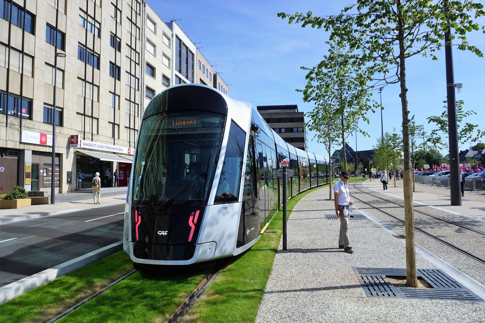
- Light rail or tram networks for regional and local connectivity
- Bus rapid transit (BRT) systems with dedicated lanes
- Metro services for densely populated areas
- Electric shuttle loops linking neighborhoods
The frequency of transit options matters as much as their availability. Peak service intervals under five minutes greatly boost adoption rates. Station locations should coincide with population density and mixed-use areas to maximize use and lessen internal vehicle demand. Transit infrastructure should be integrated into public spaces, not treated as separate from the development. Stations that include retail spaces, mobility hubs, and pedestrian routes enhance utilization and promote economic activity.
Micro-Mobility Integration
Micro-mobility options like shared bikes, e-scooters, and cargo bikes are essential for providing last-mile connectivity within car-free districts. These services connect transit nodes to final destinations, reducing the need for private vehicles. Successful integration involves:
- Dedicated micro-mobility lanes separate from pedestrian paths
- Secure parking and docking areas
- Charging stations for electric vehicles
- Payment systems that connect with transit networks
Cities like Amsterdam and Copenhagen exemplify how cycling infrastructure should operate as a cohesive, protected network rather than as isolated parts. For enterprise projects, micro-mobility routes should link residential areas, commercial streets, schools, and parks to ensure wide coverage. Mobility hubs centralize services like bike-sharing, scooter docking, car-sharing, and public transportation ticketing. Well-placed hubs help to alleviate congestion and simplify transitions between different modes of transport.
Freight and Service Vehicle Access
One of the biggest challenges in car-free masterplanning is managing freight logistics. Retail, hospitality, and residential areas need consistent delivery of goods, waste collection, and maintenance access. European cities tackle this issue with effective freight management systems:
- Urban consolidation centers where larger trucks transfer goods to smaller electric vehicles
- Time-restricted delivery periods to limit conflicts with pedestrians
- Designated service routes are separate from major pedestrian areas
- Cargo bike delivery networks for smaller deliveries
Barcelona's superblocks maintain access for freight at the perimeter while keeping vehicle circulation low internally. Amsterdam is increasingly utilizing cargo bikes for last-mile deliveries within crowded urban areas. Enterprise masterplans should incorporate designated loading areas at district borders and service tunnels or secondary access routes where feasible. Planning for freight early on helps avoid operational inefficiencies that could hurt retail success.
Emergency Vehicle Planning
Car-free districts need to make sure emergency vehicles can still get through at all times. Fire services, ambulances, and law enforcement vehicles need clear and easy access to buildings and public areas. Emergency planning usually includes:
- Pedestrian streets that are strengthened to handle heavy vehicle traffic
- Retractable bollards that let you control access
- The street design includes clear turning radii built right into its layout
- Digitally managed access control systems
European pedestrian districts show that you can restrict vehicles and still keep things safe when emergency access is built into the overall planning. Emergency planning needs to follow local fire codes and safety rules from the start of the approval process to prevent expensive redesigns.
Car-free transportation works well when transit infrastructure, micro-mobility networks, freight access, and emergency planning all come together and function as one connected mobility system. Enterprise developers need to see mobility as a central part of their infrastructure, not just an added feature.
Technology and Tools
Car-free urban masterplanning is leaning more and more on digital tools to check how spaces work, what the travel needs are, and whether the infrastructure can handle it all. Complex mobility ecosystems need predictive modeling and data-driven decisions to cut down on financial and operational risk.
AI-Powered Site Planning
Artificial intelligence platforms help developers test different masterplan layouts quickly and see how they affect mobility performance. AI-driven planning tools can simulate how pedestrians move, how parking needs might drop, transit access, and how crowded different areas get in various design setups.
Digital Blue Foam (DBF) helps with enterprise masterplanning by bringing together zoning rules, environmental info, and mobility data into one easy-to-use model. Developers can try out different parking ratios, street layouts, and density setups to see how they affect walkability and access to transit. By simulating mobility outcomes early on, developers can cut down on infrastructure mistakes and feel more confident about getting regulatory approval.
Simulation and Modeling Tools
Scenario-based simulation helps masterplanning teams look at:
- Traffic redistribution under restricted circulation models
- Pedestrian congestion points
- Transit demand growth across development phases
- Freight movement efficiency
Before putting it into action, Barcelona's superblock model was tested using traffic simulation. Enterprise developers can use similar modeling frameworks to look at different phasing strategies and check infrastructure capacity before spending any capital. Geospatial modeling tools help measure 5-minute and 15-minute service areas, making sure mixed-use plans support goals for living without cars.
Data-Driven Decision Making
Car-free urban development relies on ongoing data evaluation instead of fixed planning assumptions. Developers should use mobility data, demographic forecasts, and environmental performance numbers to adjust their infrastructure plans as time goes on. Performance dashboards can show:
- Modal share shifts
- Parking utilization rates
- Retail footfall
- Transit ridership
- Carbon emissions
Planning with data helps car-free districts stay flexible as more people move in and the way they're used changes. Technology doesn't take the place of design vision. It helps make decisions clearer and cuts down on guesswork during implementation. For enterprise developers, using AI-powered planning and mobility simulation tools gives them the solid analysis they need to carry out car-free urban projects on a large scale.
Financial and Risk Considerations
Car-free urban development changes how the finances work in masterplanned projects. Cutting back on parking infrastructure saves money upfront, but spending on mobility systems, improving public spaces, and gradually adding transit brings new expenses. Enterprise developers need to assess car-free strategies by looking at the full financial picture over time, not just comparing costs on their own.
Development Cost Analysis
Parking infrastructure is one of the most expensive parts of building traditional urban areas. Structured parking usually costs between $25,000 and $60,000 per space, but in crowded cities, underground parking can easily go over $100,000 per space. Cutting back on parking ratios lowers the initial building costs and opens up more land that can be used to make money. Cost savings need to be balanced with the investments required in:
- Better sidewalks and crosswalks
- Cycling networks
- Transit station integration
- Public space landscaping and green infrastructure
- Building a mobility hub
In a lot of European examples, net capital expenditure stays about the same as with traditional development models, but the money is shifted from parking spaces to creating places and improving accessibility, which helps the value of the assets grow over time.
Revenue Models
Car-free development can bring several revenue benefits if it's planned the right way.
- Cutting down on parking spaces frees up more room to build, so you can fit in more homes or have bigger storefronts. This adds more leasable square footage and boosts the chances for sales.
- Pedestrian-priority districts often have higher rents because they offer better livability and easier access. Retail tenants see more people coming in and spending extra time in the space, which helps them get better lease rates.
- Mobility hubs and shared transport services can bring in extra income by teaming up with mobility providers.
Better sustainability performance can help qualify for green financing, lower long-term operating costs, and make ESG investments more appealing. The financial model for car-free development needs to consider both shifting capital and how to capture value.
Conclusion
Car-free urban development has moved beyond just being a trial idea in city planning. In many parts of Europe, mobility-first districts have shown clear improvements in land usage, local economies, the environment, and public health. For enterprise developers, these models present a chance to cut down on parking-related capital costs, increase the amount of space they can build on, and improve how well their assets perform over time.
Successful implementation takes more than just cutting off vehicle access. It requires a solid masterplanning approach, a mix of mobility options built in stages, careful timing of each step, following the rules, and making choices based on real data. Car-free development should be seen as a big shift in how everything works together, not just one simple design change.
When enterprise developers match their mobility hierarchy design with mixed-use spaces, density planning, green infrastructure, and clear financial models, they can build urban districts that stay strong and competitive as real estate markets change.
These new planning tools let developers test out how mobility will work, figure out the best site setups, and look at the financial pros and cons before they spend any money. Using tools like Digital Blue Foam's AI-powered urban planning platform helps masterplanning teams try out different mobility options, adjust how density is spread out, and lower the risks that come with putting plans into action.
As cities focus more on sustainable mobility and improving infrastructure, enterprise developers who include car-free ideas in their masterplans early on will be better placed to lead the next wave of efficient urban development.
